

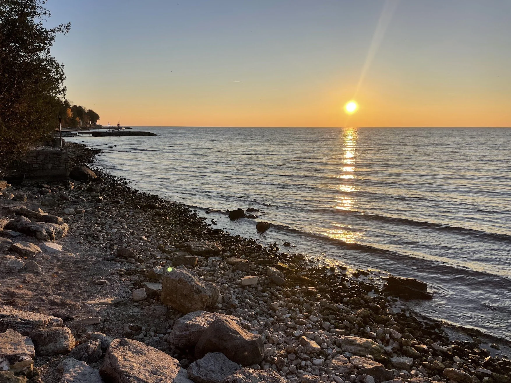
Wisconsin’s Best Sunset Spots: 30+ Places From Milwaukee to Washington Island
Wisconsin delivers an extraordinary variety of sunset views.
You can watch the sky turn orange behind the Milwaukee skyline, climb a glacial ridge above the Kettle Moraine, see the sun sink into Green Bay from Door County, look across two rivers from a Mississippi bluff or catch the final light reflecting off Lake Superior.
This guide highlights more than 30 of the best public sunset locations in Wisconsin, with an emphasis on the details families need: parking, accessibility, admission costs, walking difficulty and whether the location is practical after dark.
When does the sun set in Wisconsin?
Wisconsin’s sunset time varies considerably by location and season.
Around the summer solstice, the sun generally sets shortly after 8:30 p.m. in southeastern Wisconsin and close to 9 p.m. near Lake Superior. In December, sunset can arrive shortly after 4:15 p.m.
Because Wisconsin stretches more than four degrees from south to north, sunset in Superior can occur significantly later than it does in Kenosha or Milwaukee during summer.
Check the exact time for your destination using Timeanddate.com or a weather app that displays sunset and civil-twilight times.
A few sunset-planning tips
Arrive at least 20 to 30 minutes before sunset so you can park, find a viewing spot and let kids settle in.
Do not leave as soon as the sun disappears. The most vivid pink, purple and orange colors frequently develop during the following 10 to 25 minutes.
High clouds can produce dramatic color, while a completely cloudless sky may create a simpler golden glow. Haze, wildfire smoke and heavy low clouds can limit visibility.
Bring a flashlight or headlamp when visiting wooded trails, towers or bluff overlooks. Many paths become difficult to follow surprisingly quickly after sunset.
Milwaukee and the North Shore
Lake Michigan sits east of Milwaukee, so most local beaches do not offer a traditional sunset over the water. Instead, visitors see warm light on the skyline, colorful clouds over the lake and pink alpenglow reflecting across the water.
1. Lakeshore State Park

Location: 500 N. Harbor Drive, Milwaukee
Admission: Free
Walk: Easy and paved
Best for: Milwaukee skyline views
Lakeshore State Park is one of the best places to watch Milwaukee transition from daylight to nighttime.
The park occupies a small island behind the Summerfest grounds and includes paved paths, a fishing area, a small beach and views of the Milwaukee Art Museum, Hoan Bridge and downtown skyline.
The sun sets behind the city from many portions of the park, lighting the downtown buildings while the eastern sky takes on softer pink and purple tones.
Parking availability varies depending on festivals and events at the lakefront, so check the Summerfest and Henry Maier Festival Park calendars before visiting.
2. Lake Park and North Point Lighthouse
Location: 2650 N. Wahl Avenue, Milwaukee
Admission: Park grounds are free
Walk: Easy to moderate
Best for: Historic architecture and bluff views
Designed by renowned landscape architect Frederick Law Olmsted, Lake Park sits on a bluff above Lake Michigan.
The park’s bridges, ravines, lighthouse and mature trees become especially photogenic in warm evening light. The lake is east of the park, but visitors can see colorful clouds over the water and golden light across the lighthouse grounds.
The North Point Lighthouse has limited public-tour hours and should not be counted on as an evening observation tower. Check its official schedule before planning a climb.
3. Klode Park
Location: 5960 N. Lake Drive, Whitefish Bay
Admission: Free
Walk: Easy on the bluff; moderate to the beach
Best for: Picnics, playground time and relaxed family evenings
Klode Park combines a grassy bluff, playground, picnic areas and a path down to Lake Michigan.
The bluff lawn is often the easiest place for families to spread out a blanket and watch the evening sky. The beach below provides a quieter setting, although the return climb is more difficult after dark.
Learn more in our guide to Whitefish Bay and North Shore beaches.
4. Atwater Park
Location: 4000 N. Lake Drive, Shorewood
Admission: Free
Walk: Easy on the bluff; stairs or a longer path to the beach
Best for: Bluff-top views and families with younger children
Atwater Park offers a playground and open lawn at the top of the bluff, plus beach access below.
For sunset, the upper park is usually the most convenient viewing location. Families can stay near the playground and avoid climbing back from the beach in darkness.
The park faces east, so expect reflected color over Lake Michigan rather than the sun dropping directly into the water.
See our North Shore parks guide for more nearby stops.
5. Doctors Park
Location: 1870 E. Fox Lane, Fox Point
Admission: Free
Walk: Moderate wooded descent
Best for: A secluded beach experience
Doctors Park includes a bluff-top playground and a wooded trail leading down to a small Lake Michigan beach.
The beach is framed by trees and stone structures, creating a peaceful setting as the evening light fades. The wooded return route becomes dark quickly, so begin hiking back before the end of civil twilight and bring a flashlight.
Southeast Wisconsin’s glacial hills and towers
The Kettle Moraine gives southeastern Wisconsin something the shoreline cannot: elevated, west-facing views.
One important caution applies throughout this section. Observation towers and park gates may close before or near sunset, especially outside summer. Always confirm operating hours before making a special trip.
6. Lapham Peak
Location: W329 N846 County Highway C, Delafield
Admission: Wisconsin State Park vehicle sticker required
Walk: Short to moderate, depending on parking
Best for: Panoramic Kettle Moraine views
Lapham Peak is the highest point in Waukesha County and one of the easiest elevated destinations to reach from Milwaukee.
Its observation tower rises above the surrounding forest and provides expansive views across southeastern Wisconsin. The park is especially beautiful during fall-color season.
Because tower or trail access can be affected by weather, maintenance and seasonal restrictions, check current Wisconsin DNR conditions before visiting.
7. Holy Hill
Location: 1525 Carmel Road, Hubertus
Admission: Free; donations appreciated
Walk: Numerous stairs to the tower
Best for: Late-afternoon golden light and fall color
The Basilica and National Shrine of Mary Help of Christians at Holy Hill sits atop one of the highest points in southeastern Wisconsin.
Its scenic tower provides remarkable views of the Kettle Moraine, but it is important to understand that the tower normally closes well before summer sunset.
For 2026, the tower is scheduled to operate May 1 through October 31, generally from 9 a.m.–4:30 p.m. Monday through Saturday and 1:30–4:30 p.m. Sunday. Weather, religious services and other conditions can cause additional closures. Check Holy Hill’s current visitor information before driving out.
That makes Holy Hill a better choice for golden-hour light during fall, when sunset occurs earlier, rather than a midsummer sunset from the tower.
Read our complete Holy Hill family day-trip guide.
8. Pike Lake and Powder Hill
Location: 3544 Kettle Moraine Road, Hartford
Admission: Wisconsin State Park vehicle sticker required
Walk: Approximately one-half mile from the closest trailhead
Best for: A tower hike paired with a beach day
The Pike Lake Unit of the Kettle Moraine State Forest includes a beach, campground and trail leading to the observation tower on Powder Hill.
From the tower, visitors can see the surrounding forest, farmland and distant Holy Hill area. This is a wooded hike, so bring lighting for the return and check park conditions before planning to remain close to closing time.
9. Parnell Tower
Location: Kettle Moraine State Forest–Northern Unit, near County Highway U
Admission: Wisconsin State Park vehicle sticker required
Walk: Moderate, with stairs
Best for: A more remote Kettle Moraine experience
Parnell Tower rises above the forest in the Northern Unit of the Kettle Moraine State Forest.
It offers a broad view above the treetops, but the site is more rustic than Lapham Peak or Holy Hill. Expect limited facilities, a wooded walk and mosquitoes during warmer months.
Families should leave enough daylight to return safely to the parking area.
Lake Michigan north of Milwaukee
10. Lion’s Den Gorge Nature Preserve
Location: 511 High Bluff Drive, Grafton
Admission: Free
Walk: Easy to moderate
Best for: Bluff trails and dramatic shoreline scenery
Lion’s Den Gorge includes wetlands, wooded trails, Lake Michigan bluffs and stair access to the beach.
The preserve faces east, so it is better for golden light on the bluffs and colorful reflected skies than a direct over-water sunset. Stay on designated paths and behind safety barriers near the bluff edge.
11. Harrington Beach State Park
Location: 531 County Road D, Belgium
Admission: Wisconsin State Park vehicle sticker required
Walk: Easy to moderate
Best for: Beach, quarry lake and stargazing
Harrington Beach State Park offers both a Lake Michigan shoreline and an inland quarry lake.
The quarry can reflect western sky color, providing a more traditional sunset composition than the east-facing beach. The park also hosts public astronomy programming on selected nights, making it possible to pair sunset with stargazing.
12. Kohler-Andrae State Park
Location: 1020 Beach Park Lane, Sheboygan
Admission: Wisconsin State Park vehicle sticker required
Walk: Easy to moderate
Best for: Dunes, boardwalks and silhouettes
Kohler-Andrae State Park is known for its sand dunes, Lake Michigan beach and cordwalk trails.
Although the lake sits to the east, the dunes and grasses catch warm evening light beautifully. Some inland portions of the park also offer views toward the western sky.
Door County’s best sunset locations
Door County deserves a full section because the peninsula’s Green Bay shoreline faces west.
That means many communities offer an unobstructed view of the sun dropping toward or directly over the water. It is also possible to watch sunrise on the Lake Michigan side and sunset on the bay side during the same day.
For a deeper dive, see our complete guide to Door County’s best sunset spots and our Door County family travel guide.
13. Sunset Park in Sturgeon Bay
Location: 747 N. Third Avenue, Sturgeon Bay
Admission: Free
Walk: Easy
Best for: Accessibility and multi-generational groups
Sunset Park is one of the easiest Door County sunset locations to visit with young children, grandparents, strollers or mobility devices.
The park faces west across Sturgeon Bay and includes beach access, playgrounds, picnic areas and plenty of open shoreline.
Working shipyard structures and passing boats can create memorable silhouettes against the evening sky.
14. Potawatomi State Park
Location: 3740 County Highway PD, Sturgeon Bay
Admission: Wisconsin State Park vehicle sticker required
Walk: Varies
Best for: Wooded shoreline and elevated Green Bay views
Potawatomi State Park occupies a wooded stretch of shoreline northwest of Sturgeon Bay.
The park’s western exposure provides sunset views over Green Bay, while trails and picnic areas make it easy to turn the visit into a longer afternoon outing.
Check current DNR conditions before relying on a particular overlook or trail.
15. Harbor View Park in Egg Harbor
Location: Downtown Egg Harbor waterfront
Admission: Free
Walk: Easy
Best for: A sunset paired with dinner or ice cream
Harbor View Park is a convenient sunset stop in downtown Egg Harbor.
The elevated lawn overlooks the marina and Green Bay, and visitors can walk to nearby restaurants and shops. Arrive early during summer because the small downtown area can become crowded around dinner and sunset.
16. Peninsula State Park and Eagle Tower
Location: Fish Creek
Admission: Wisconsin State Park vehicle sticker required
Walk: Accessible ramp or stairs
Best for: Door County’s signature elevated view
Eagle Tower is one of Wisconsin’s most accessible observation towers.
The structure sits on Eagle Bluff and can be reached by stairs or an approximately 850-foot accessible canopy walk. From the top, visitors can see Green Bay, nearby islands, Ephraim and portions of northern Door County.
Peninsula State Park is open from 6 a.m.–11 p.m., but Eagle Tower is seasonal and is generally available from approximately May 1 through October 31, weather permitting. Check the Peninsula State Park conditions page before visiting.
Because trees and terrain affect the exact angle, Eagle Tower is best considered a panoramic golden-hour location rather than a guaranteed unobstructed view of the sun touching the horizon.
17. Fish Creek’s Sunset Beach Park
Location: End of Main Street, Fish Creek
Admission: Free
Walk: Easy
Best for: A classic village sunset
Sunset Beach Park is small, but its west-facing shoreline and convenient location make it one of Door County’s most popular evening gathering places.
There is limited parking near the park. Walking from downtown Fish Creek is often easier during peak season.
18. Ephraim waterfront
Location: Along Highway 42 in Ephraim
Admission: Free
Walk: Easy
Best for: Iconic Door County scenery
Ephraim’s shoreline offers views across Eagle Harbor toward Peninsula State Park.
The village’s white buildings, docks and boats make this one of the most recognizable sunset scenes in Door County. Public shoreline areas are scattered along the waterfront, so walk around and choose a viewpoint before the sun gets low.
19. Sister Bay Beach and Waterfront Park
Location: Downtown Sister Bay
Admission: Free
Walk: Easy
Best for: Families who want amenities close by
Sister Bay’s waterfront combines a beach, playground, marina, lawn and easy access to restaurants.
It is an excellent choice when different members of the family want different things. Kids can use the playground, adults can settle near the water and everyone can walk for ice cream afterward.
20. Ellison Bluff County Park
Location: Ellison Bay
Admission: Free
Walk: Easy to moderate
Best for: A dramatic wooded bluff
Ellison Bluff County Park includes a forested route leading to an overlook above Green Bay.
The viewing platform provides a broad westward view, although trees can frame or partially limit some angles. The access road and trails may feel rustic, and the forest becomes dark quickly after sunset.
21. Door Bluff Headlands County Park
Location: Near Gills Rock
Admission: Free
Walk: Rugged
Best for: Experienced hikers seeking a natural setting
Door Bluff Headlands is one of northern Door County’s more rugged public preserves.
It is not the best choice for toddlers, strollers or anyone expecting a maintained waterfront park. Trails can be uneven and the shoreline includes steep terrain.
Visit in daylight first, remain well back from cliff edges and do not attempt an unfamiliar route after dark.
22. Newport State Park
Location: 475 County Highway NP, Ellison Bay
Admission: Wisconsin State Park vehicle sticker required
Walk: Moderate
Best for: Sunset followed by exceptional stargazing
Newport State Park occupies the Lake Michigan side of the peninsula, so not every beach provides a direct western sunset. However, its open shoreline, quiet environment and internationally recognized dark skies make it an outstanding place to watch evening color transition into night.
The park is Wisconsin’s first designated International Dark Sky Park. Bring red-light flashlights and allow your eyes time to adjust after sunset.
Washington Island sunsets and the ferry
Washington Island adds an important planning complication: the standard ferry schedule often ends before sunset.
The Washington Island Ferry Line crosses Death’s Door from Northport Pier to Detroit Harbor. The trip takes approximately 30 minutes.
During the main summer schedule from June 19 through September 7, 2026, ferries depart frequently during the day. Most regular return trips from the island end around 6 p.m., which is well before sunset in June, July and much of August.
Friday-night ferry opportunity
From June 26 through September 4, 2026, the ferry line lists additional Friday-night service:
From the island to the mainland:
7 p.m.
7:30 p.m.
8:30 p.m.
From the mainland to the island:
7:45 p.m.
8:15 p.m.
9:15 p.m.
These trips may allow passengers to experience late golden hour or sunset from the ferry, depending on the date. However, the exact relationship between departure time and sunset changes throughout the season.
Always verify the day’s Washington Island Ferry schedule before making plans. Weather, demand and operational conditions may affect service.
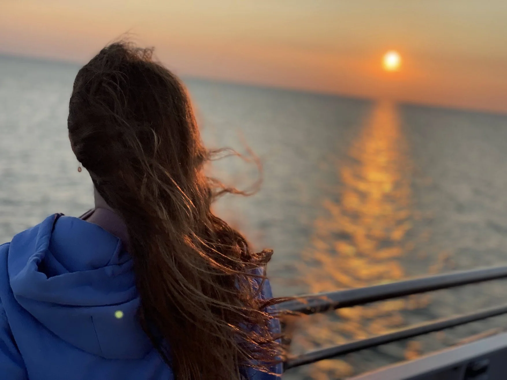
23. Sunset from the Washington Island Ferry
Location: Northport Pier to Detroit Harbor
Cost: Ferry fare required
Walk: Minimal
Best for: Open-water views and a memorable Door County experience
When timing lines up, the Washington Island Ferry provides one of Wisconsin’s most unusual sunset experiences.
Passengers can see northern Door County, surrounding islands, open water and vessels traveling through Death’s Door. Bring a jacket, even on warm summer days, because conditions on the open deck can be windy and considerably cooler than on land.
Do not assume you can take a sunset ferry and immediately return. Carefully compare the schedule in both directions before boarding.
24. People’s Park on Washington Island
Location: Washington Island
Admission: Free
Walk: Short but may include uneven terrain
Best for: A peaceful island sunset
People’s Park offers a west-facing overlook above Green Bay and is one of Washington Island’s best-known sunset locations.
Because most regular ferries leave before sunset, this stop is most practical for overnight island visitors or those visiting when late ferry service is scheduled.
Parking is limited, so arrive early and avoid blocking the access road.
25. Gislason Beach and Detroit Harbor
Location: Near the Washington Island ferry landing
Admission: Free
Walk: Easy
Best for: A convenient island shoreline stop
Gislason Beach and the Detroit Harbor area offer calm waterfront views close to the ferry landing.
The exact sunset angle changes through the season, but the harbor can produce attractive reflections and boat silhouettes during evening light.
Read our complete Washington Island family guide before planning your trip.
What about Schoolhouse Beach?
Schoolhouse Beach is one of Washington Island’s signature attractions, but it faces north rather than directly west.
It can still be beautiful during golden hour, especially when clouds catch color, but People’s Park is generally the stronger choice for a direct sunset view.
What about Rock Island State Park?
Rock Island State Park can deliver magnificent sunsets, but it requires a second passenger ferry from Jackson Harbor on Washington Island.
Visitors must carefully follow the Rock Island Ferry schedule. The normal day-use schedule does not make a casual sunset visit and same-night return practical.
Rock Island is therefore best treated as an overnight camping destination for sunset viewing. It has no cars or bicycles, and visitors need to carry their supplies from the ferry landing.
Lake Winnebago
26. High Cliff State Park
Location: N7630 State Park Road, Sherwood
Admission: Wisconsin State Park vehicle sticker required
Walk: Easy to moderate
Best for: Elevated views across Lake Winnebago
High Cliff State Park sits on the east side of Lake Winnebago, providing broad westward views across the water.
The upper park contains overlooks, trails and the Chief Red Bird statue. Its observation tower has experienced periodic closures and restrictions, so check the Wisconsin DNR’s current park conditions rather than assuming it will be available.
Even without the tower, the escarpment and shoreline areas make High Cliff one of Wisconsin’s strongest inland sunset destinations.
27. Lakeside Park in Fond du Lac
Location: 555 N. Park Avenue, Fond du Lac
Admission: Free
Walk: Easy
Best for: Families seeking lots of activities
Lakeside Park occupies the southern end of Lake Winnebago and includes playgrounds, picnic areas, waterfront paths and a recognizable lighthouse.
The lighthouse has traditionally offered seasonal public access, but climbing hours can change. Confirm current City of Fond du Lac information before promising children a tower climb.
The park itself remains a convenient place to watch evening light spread across the lake.
Madison-area sunsets
28. Memorial Union Terrace
Location: 800 Langdon Street, Madison
Admission: Free to visit
Walk: Easy and accessible
Best for: Food, music and a lively atmosphere
The Memorial Union Terrace is Madison’s most celebrated sunset destination.
Its colorful chairs face Lake Mendota, with food, drinks, restrooms and seasonal entertainment close by. The combination of open water and a lively campus setting makes this one of Wisconsin’s easiest sunset experiences.
Parking near the university can be challenging. Review UW–Madison visitor-parking options before arriving.
29. Governor Nelson State Park
Location: 5140 County Highway M, Waunakee
Admission: Wisconsin State Park vehicle sticker required
Walk: Easy to moderate
Best for: Prairie, beach and Lake Mendota views
Governor Nelson State Park sits on the northwestern shore of Lake Mendota.
The beach and shoreline provide evening views across the lake, while prairie trails catch warm light. The park also includes Indigenous effigy mounds that must be treated respectfully and viewed only from designated areas.
Central Wisconsin and the Wisconsin River
30. Devil’s Lake State Park
Location: S5975 Park Road, Baraboo
Admission: Wisconsin State Park vehicle sticker required
Walk: Easy at lake level; strenuous on bluff trails
Best for: Dramatic cliffs and reflected light
Devil’s Lake is Wisconsin’s most-visited state park, with a lake framed by steep quartzite bluffs.
The West Bluff and portions of the south shore catch warm evening light, but visitors should not underestimate the terrain. Bluff trails include steep stone steps, uneven surfaces and exposed drop-offs.
Families with young children may prefer watching the evening from the lakefront rather than descending from a bluff after dark.
Read our complete Devil’s Lake State Park guide.
31. Ferry Bluff State Natural Area
Location: Near Sauk City
Admission: Free
Walk: Moderate uphill hike
Best for: Wisconsin River views
Ferry Bluff rises above the Lower Wisconsin River and provides a westward view over the river valley.
The upper bluff includes steep, unfenced terrain and is not suitable for unsupervised young children. The natural area also has a seasonal closure to protect wintering bald eagles, generally from December 1 through March 31.
Check current Wisconsin DNR notices before visiting.
32. Roche-A-Cri State Park
Location: 1767 State Highway 13, Friendship
Admission: Wisconsin State Park vehicle sticker required
Walk: Strenuous stairs
Best for: A unique sandstone formation
Roche-A-Cri rises dramatically above the central Wisconsin landscape.
A long staircase leads toward the top, but stair and overlook access can be closed due to weather, maintenance or seasonal conditions. Because gates and stairways may close near sunset, this is better treated as a late-afternoon golden-hour stop than a place to remain after dark.
The park also protects significant Indigenous rock art. Visitors must remain on marked routes and never touch or mark the rock surfaces.
The Mississippi River and Driftless Region
33. Grandad Bluff
Location: 3020 Grandad Bluff Road, La Crosse
Admission: Free
Walk: Very easy from the upper parking area
Best for: A drive-up panoramic view
Grandad Bluff rises approximately 600 feet above La Crosse and provides expansive views over the Mississippi River Valley.
Its upper viewing area makes it one of Wisconsin’s most accessible major overlooks. On clear days, visitors can see portions of Wisconsin, Minnesota and Iowa.
Parking is limited during popular times, so arrive well before sunset.
34. Wyalusing State Park
Location: 13081 State Park Lane, Bagley
Admission: Wisconsin State Park vehicle sticker required
Walk: Varies by overlook
Best for: The Wisconsin–Mississippi river confluence
Wyalusing State Park sits high above the meeting point of the Wisconsin and Mississippi rivers.
Several overlooks provide broad western views. Some can be reached with relatively short walks, while others involve trails and uneven terrain.
The park’s bluff-top campground is extremely popular and often requires reservations far in advance.
35. Buena Vista Park
Location: Alma
Admission: Free
Walk: Easy from the upper parking area
Best for: An accessible Mississippi River overlook
Buena Vista Park overlooks Alma, the Mississippi River, Lock and Dam No. 4 and the backwaters surrounding Lake Pepin.
The ability to drive close to the viewpoint makes it a strong option for families traveling with grandparents or anyone who cannot complete a steep hike.
36. Perrot State Park and Brady’s Bluff
Location: W26247 Sullivan Road, Trempealeau
Admission: Wisconsin State Park vehicle sticker required
Walk: Strenuous
Best for: Experienced family hikers
Brady’s Bluff offers an outstanding view over the Mississippi River and Trempealeau Mountain.
The climb includes steep sections and numerous stairs. Families should begin early enough to reach the parking area before darkness.
For a less demanding evening, use lower overlooks and shoreline areas within the park.
Lake Superior
37. Wisconsin Point
Location: Superior
Admission: Free
Walk: Easy on the beach; hazardous on the breakwater
Best for: Lighthouse and harbor silhouettes
Wisconsin Point extends between Lake Superior and the St. Louis River estuary.
Its western position creates strong evening views toward Duluth and the harbor, with freighters and the Superior Entry Lighthouse adding visual interest.
Visitors should not walk onto breakwater rocks during rough conditions. Waves, slippery surfaces and changing weather can make the area dangerous.
Respect all marked cultural and burial sites.
38. Cornucopia Harbor
Location: Cornucopia
Admission: Free
Walk: Easy
Best for: A relaxed small-town Lake Superior evening
Cornucopia’s harbor, marina and public beach create one of the most family-friendly sunset settings along Lake Superior.
The shoreline curves around Siskiwit Bay, allowing evening color to reflect across the water. The community also has nearby food, a small museum and public amenities during the visitor season.
39. Meyers Beach
Location: Apostle Islands National Lakeshore near Cornucopia
Admission: National Park Service parking fee may apply
Walk: Easy to the beach; strenuous for the sea-cave trail
Best for: Sandstone cliffs and paddling
Meyers Beach is the mainland access point for the Apostle Islands sea caves.
The beach itself is easy to reach, but the Lakeshore Trail to elevated cave viewpoints is considerably more demanding and includes roots, stairs and uneven terrain.
Kayaking near the caves requires appropriate equipment, experience and a careful review of Lake Superior conditions. Calm weather at the beach does not guarantee safe paddling conditions farther along the cliffs.
Use the National Park Service Apostle Islands conditions page before heading onto the water.
Northwoods lakes
40. Torpy Park in Minocqua
Location: Downtown Minocqua
Admission: Free
Walk: Easy
Best for: Beach, playground and downtown convenience
Torpy Park sits along Lake Minocqua near downtown shops and restaurants.
Its beach, playground and open shoreline make it easy to combine a sunset with dinner or ice cream. Seasonal concerts and events may increase crowds, so check the local calendar.
41. Crystal Lake
Location: Northern Highland-American Legion State Forest
Admission: Wisconsin State Park vehicle sticker required
Walk: Easy around the main recreation area
Best for: Calm-water reflections and camping
Crystal Lake offers a classic Northwoods scene with clear water, forested shoreline and camping nearby.
The best sunset angle depends on the section of shoreline and season, but calm evenings can produce beautiful reflections.
Mosquitoes can be intense around dusk, particularly during early summer. Pack insect repellent and keep lighting available for the walk back to your vehicle or campsite.
Choosing the best Wisconsin sunset for your family
For the easiest drive-up views, start with Grandad Bluff, Buena Vista Park, Sunset Park in Sturgeon Bay or Lakeside Park in Fond du Lac.
For a sunset paired with food and activity, choose the Memorial Union Terrace, Sister Bay waterfront, Egg Harbor or Lakeshore State Park.
For an elevated hike, consider Lapham Peak, Pike Lake, Brady’s Bluff or Eagle Tower—but confirm tower and trail access before leaving home.
For a true over-water sunset, Door County’s Green Bay shoreline is difficult to beat. Ephraim, Fish Creek, Sister Bay and Egg Harbor all provide easy family-friendly views.
For the most distinctive experience, spend a night on Washington Island and watch the sunset from People’s Park, or time a summer Friday trip around the Washington Island Ferry’s late service.
Wisconsin’s best sunsets are not limited to one season or region. They can appear over city skylines, inland lakes, working harbors, prairie ridges, quiet islands and some of the largest freshwater coastlines in the world.
The essential ingredients are simple: an open western horizon, a little cloud cover, enough time to stay after the sun disappears and a safe plan for getting back before full darkness.

Where to get the best burger in Door County, Wisconsin? Here’s our guide from award-winning Husby's to dive-bar legends, brewery patties, and waterfront tiki bars