

Shorewood’s Greenway Plan: Safer Routes for Walking, Biking and Rolling
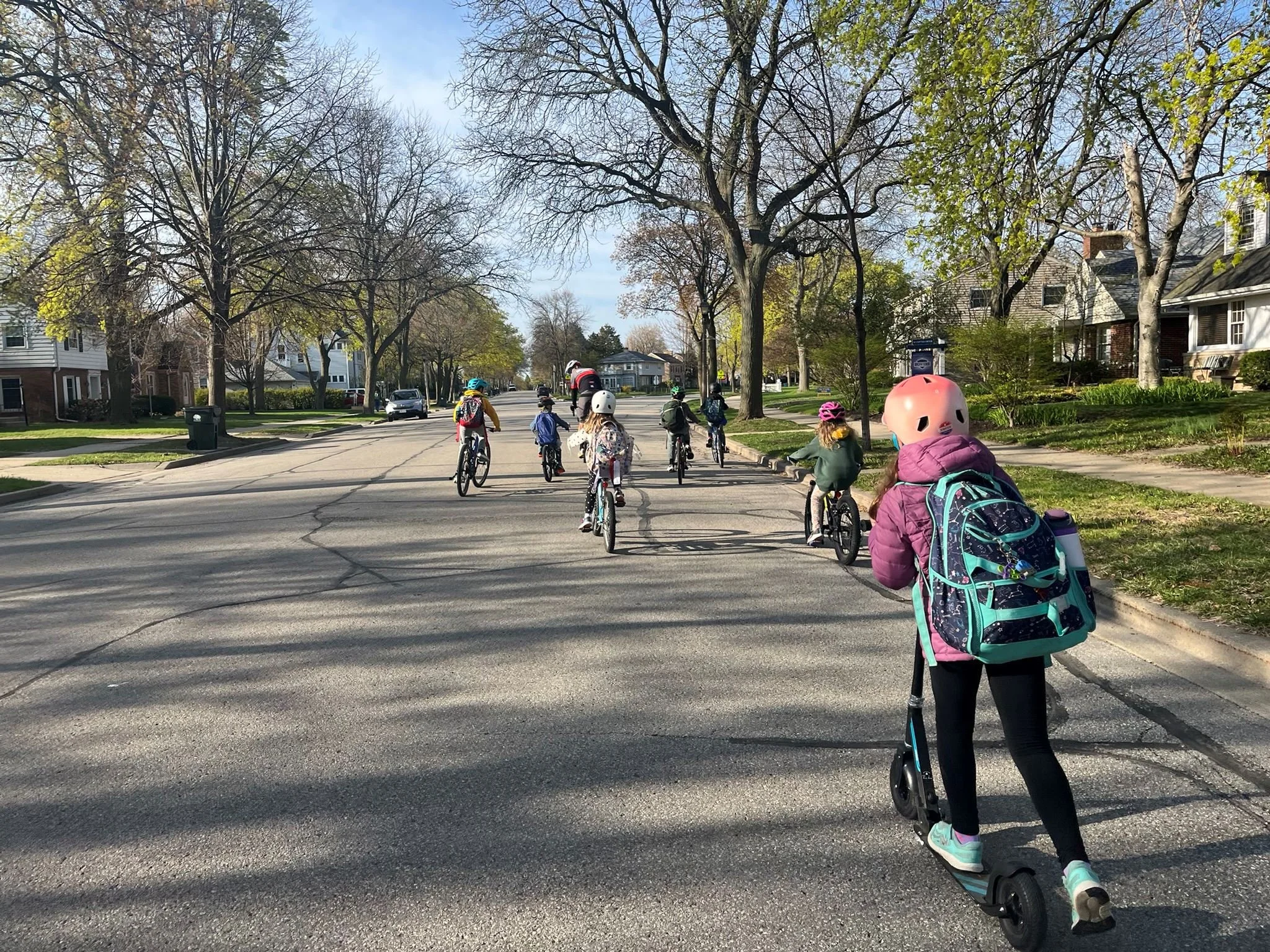
Shorewood’s neighborhood greenway project is moving beyond a general vision for safer streets.
An updated map identifies 27 potential intersection projects and shows several additions to the proposed network, including new connections along Jarvis Street, Shorewood Boulevard, Menlo Boulevard and Prospect Avenue.
The recommendations are still being developed. The map does not mean that every route or intersection project has been approved, funded or scheduled for construction. But it gives residents a clearer picture of where Shorewood is looking—and which everyday walking and biking connections could eventually change.
Where Would Shorewood’s Greenways Go?
Neighborhood greenways are lower-stress residential streets designed to make walking, biking and rolling more comfortable.
They are not the same as a completely separated trail. Instead, they generally use quieter neighborhood streets and may add signs, pavement markings, traffic-calming infrastructure or improved major-street crossings.
On Shorewood’s updated neighborhood greenway map, solid green lines represent routes already included in the proposed network. Dotted green lines show added connections.
The network includes or connects with corridors such as:
Kensington Boulevard
Congress Street
Lake Bluff Boulevard
Olive Street and Kenmore Place
Jarvis Street
Shorewood Boulevard
Menlo Boulevard
Murray Avenue
Prospect Avenue
Edgewood Avenue
The map also shows connections with bicycle lanes along Oakland Avenue and Lake Drive, the off-street trail system near the Milwaukee River, and other bicycle routes.
For families, the value would be in the connections. The proposed network could make it easier to travel between residential neighborhoods, schools, the library, parks, commercial areas and regional trails.
Families interested in the larger trail system can also explore our Ultimate Oak Leaf Trail Guide.
The Map Highlights 27 Intersection Projects
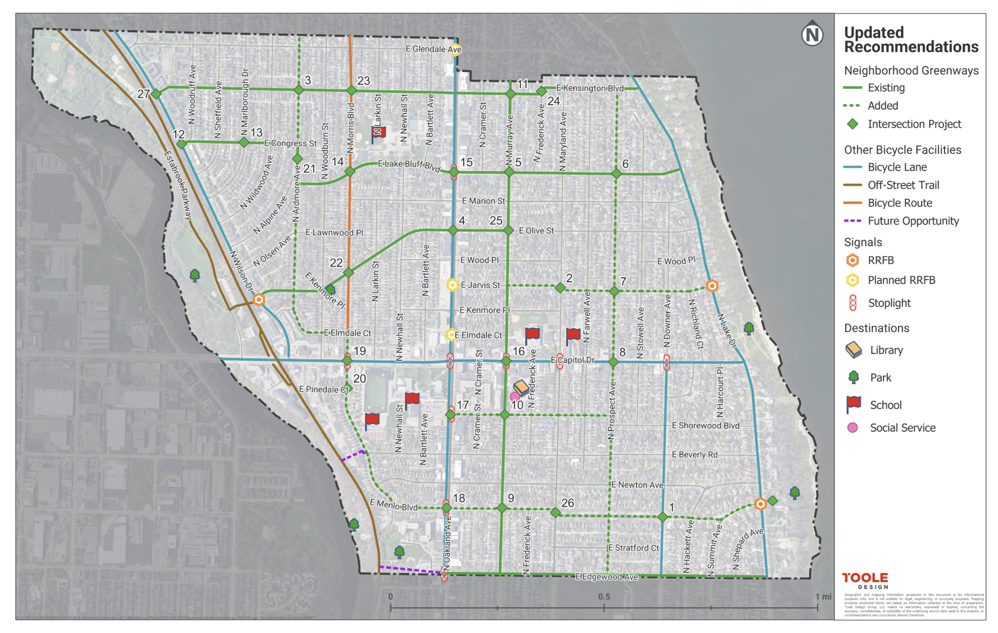
One of the most significant details in the updated map is the identification of 27 potential intersection projects.
That emphasis reflects a central challenge in Shorewood: many residential streets already have comparatively low traffic volumes, but crossing a larger road can interrupt an otherwise comfortable walking or biking trip.
The map also identifies existing and planned rectangular rapid-flashing beacons, commonly called RRFBs. These pedestrian-activated flashing signals are intended to increase driver awareness at crossings.
The public documents do not yet assign a final design to every numbered intersection. Depending on the location, future recommendations could include treatments such as:
Curb extensions
Pedestrian refuge islands
Neighborhood traffic circles
Bike boxes
Signs and pavement markings
Changes intended to improve visibility
Other measures designed to reduce vehicle speeds
The public draft is expected to provide more detail about the recommended treatment, estimated cost and implementation priority for individual locations.
Which Streets Concern Residents Most?
Between May and June 2026, Shorewood residents were invited to mark safe and unsafe locations using an online map.
A total of 136 people participated in the online exercise, placing more than 200 points on the map.
Five roads emerged as particularly challenging to cross:
Capitol Drive
Oakland Avenue
Wilson Drive
Murray Avenue
Kensington Boulevard
Capitol Drive and Oakland Avenue received even more attention during the Village’s later pop-up events.
Residents said some existing crossings still do not feel safe or provide adequate visibility. Concerns included parked vehicles blocking sightlines, turning drivers, drivers rolling through stop signs and motorists failing to yield.
Visibility concerns were especially common around Oakland Avenue, Shorewood schools and the library—places where parking, vehicle traffic and pedestrian activity frequently overlap.
Families Want Safer Everyday Trips
The feedback was not primarily about recreational bike rides.
Residents expressed stronger interest in improving short, everyday trips, particularly trips to and from school. People also discussed connections to the library, local businesses, parks, Hubbard Park and the Shorewood Nature Preserve.
That distinction matters. A useful neighborhood greenway network needs to help residents reach destinations—not simply place greenway signs on streets that are already relatively quiet.
The project also aims to encourage people biking to use the street rather than the sidewalk. Designing streets where bicyclists feel comfortable could reduce conflicts with people walking, children and residents using mobility devices.
Shorewood already performs well in broader assessments of bicycle accessibility. Read more about why Shorewood was named a top biking community.
More Than 800 People Participated During Greenway Days
Shorewood held Greenway Days from July 8–12, 2026, to gather more detailed feedback.
Project staff operated 12 pop-up stations and spoke with more than 500 people. Residents were asked to identify their biggest walking and biking concerns and mark the areas they believed should be improved first.
On July 11, more than 300 people participated in a four-hour event along portions of the proposed network. Temporary signs and chalk markings helped people experience what a neighborhood greenway could feel like.
Eight demonstration stations showed examples including:
Neighborhood traffic circles
Bike boxes
A contraflow bike lane
Curb extensions
Pedestrian islands
Residents were able to rate the demonstrations and offer feedback.
Some participants worried that traffic-calming infrastructure could look unattractive or become difficult to maintain. Others saw opportunities to add plantings, public art and additional green space.
The project will therefore need to balance safety, appearance, maintenance and cost.
Shorewood Is Also Developing a Traffic-Calming Program
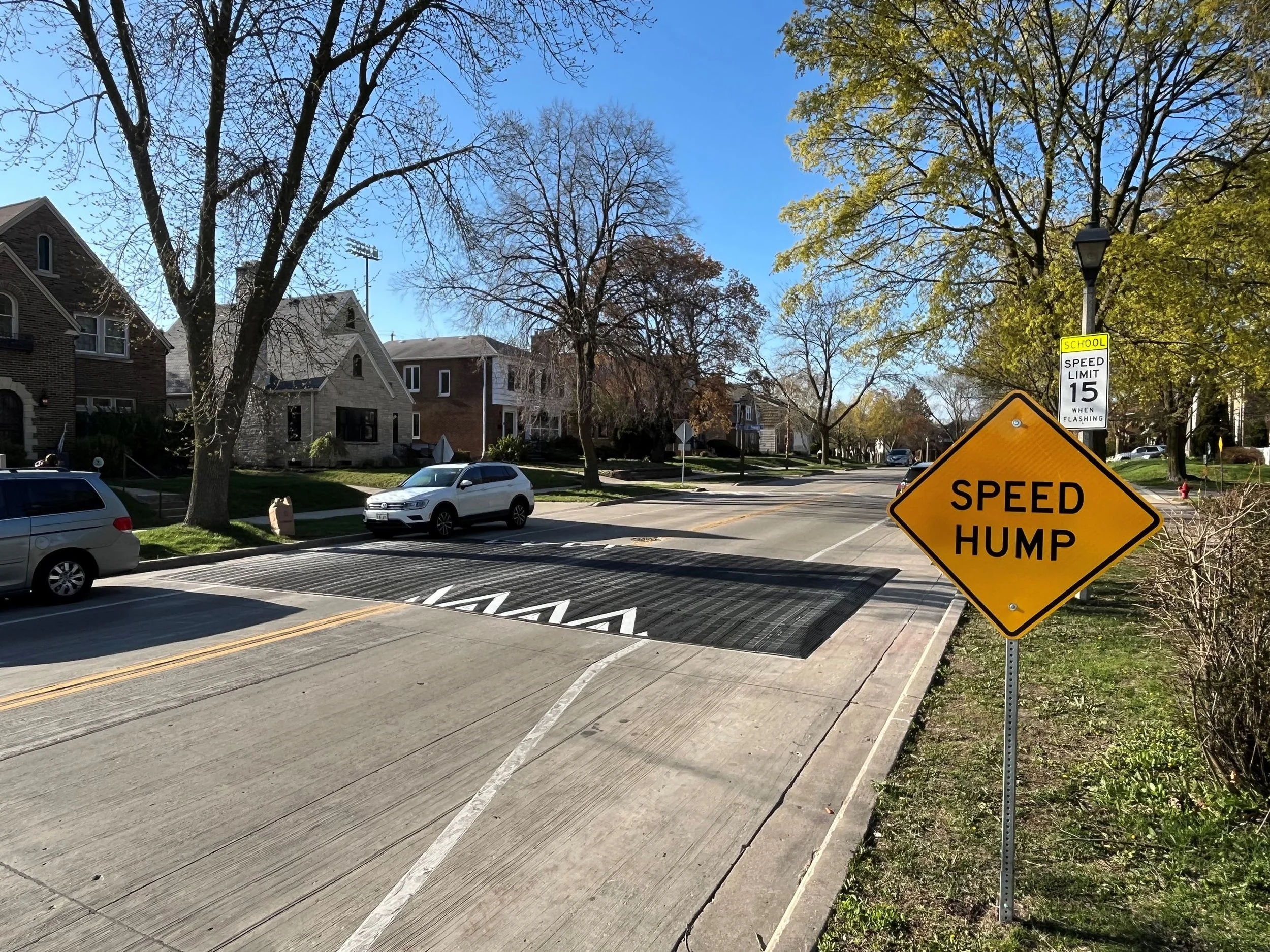
The Village is developing two related but distinct products.
The greenway plan will recommend routes and improvements for the connected network. A separate traffic-calming program will determine how residents can request safety improvements elsewhere in Shorewood.
The program is expected to answer questions including:
Which streets are eligible?
Who may submit a request?
What information must an applicant provide?
Which traffic and safety data will be considered?
Will requests be reviewed as they arrive or together at scheduled times?
How will projects be prioritized?
Will neighborhood support or resident signatures be required?
How will improvements be funded?
Who makes the final decision?
Consultants reviewed traffic-calming programs in Wauwatosa, Milwaukee, Madison, Bloomington and Whitefish Bay. Those communities use different combinations of traffic data, crash history, proximity to schools, bicycle and pedestrian network gaps, neighborhood support and project cost.
Those examples are informing Shorewood’s work, but the Village has not yet adopted a final application or evaluation process.
How Did Shorewood Get Here?
The Village Board adopted Shorewood’s updated Pedestrian and Bicycle Master Plan on March 3, 2025. That plan proposed a neighborhood greenway network and called for additional work to identify appropriate designs, costs and priorities.
We covered that broader vision in our previous article about Shorewood’s pedestrian improvements.
Detailed greenway planning began in spring 2026 with consultant Toole Design. The team reviewed street characteristics, vehicle speeds, crash data and community feedback before updating the potential network.
The Village says proposed recommendations will be released for public review before the final plan is presented to the Village Board.
What Happens Next?
The most important document is still to come: a public draft matching proposed locations with particular improvements, estimated costs and implementation phases.
Until that report is released, the 27 numbered locations should be treated as potential project sites—not approved construction projects.
Residents can follow the Village’s Neighborhood Greenways and Traffic Calming Program for the public draft, comment opportunities and future meeting information.
Which street or intersection would make the biggest difference in your family’s everyday walking or biking trips? Let us know in the comments.
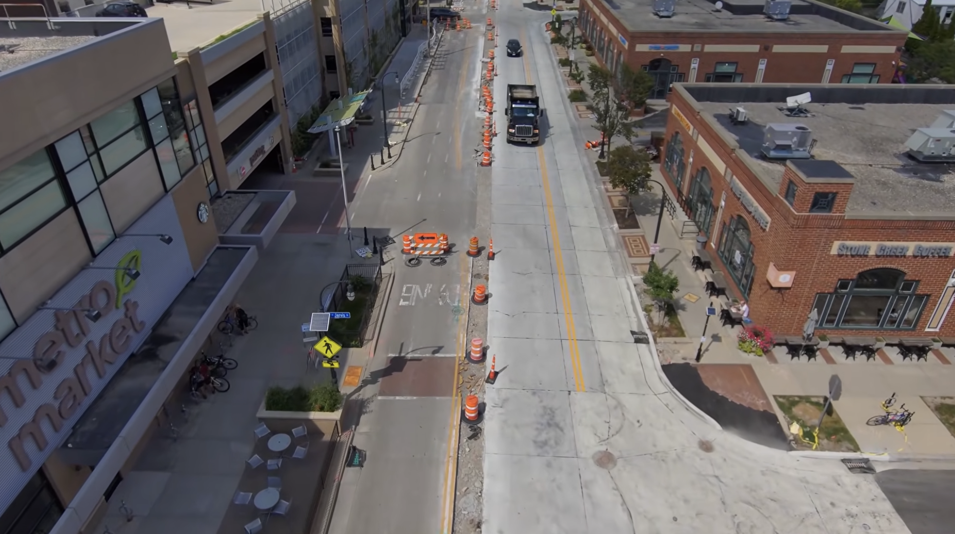

Learn how Shorewood’s proposed neighborhood greenways and traffic-calming program could create safer routes for families walking, biking and rolling.