

Safer Streets: How North Shore Roads Are Changing
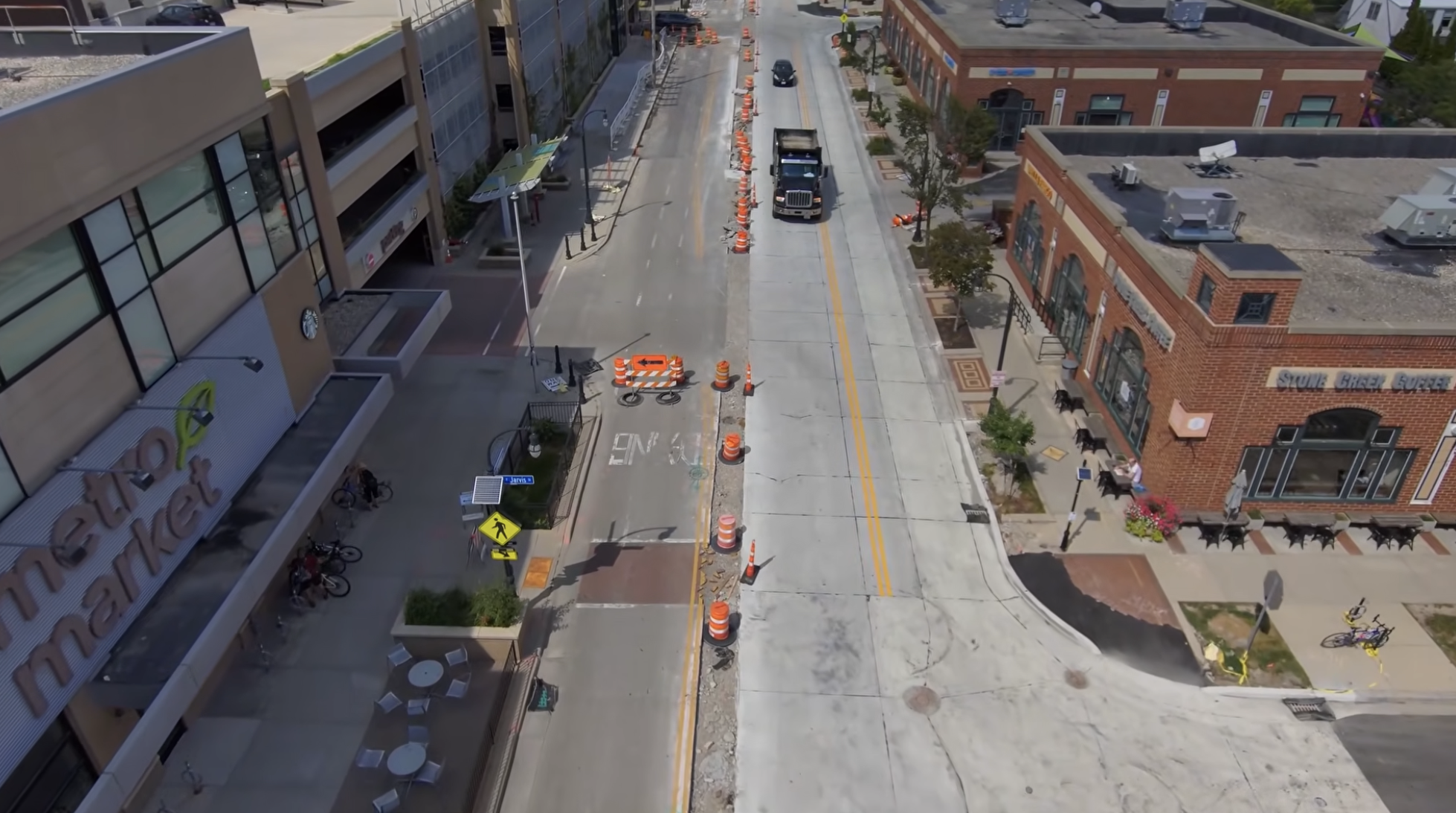
Oakland Avenue Construction
If it feels like every trip around Milwaukee’s North Shore involves construction cones lately, there’s a reason.
Oakland Avenue is being rebuilt in Shorewood. Silver Spring Drive is under construction in Glendale. Streets around Whitefish Bay’s new Sendik’s are changing. Temporary traffic-calming features have appeared near schools. Shorewood is developing a neighborhood greenway network.
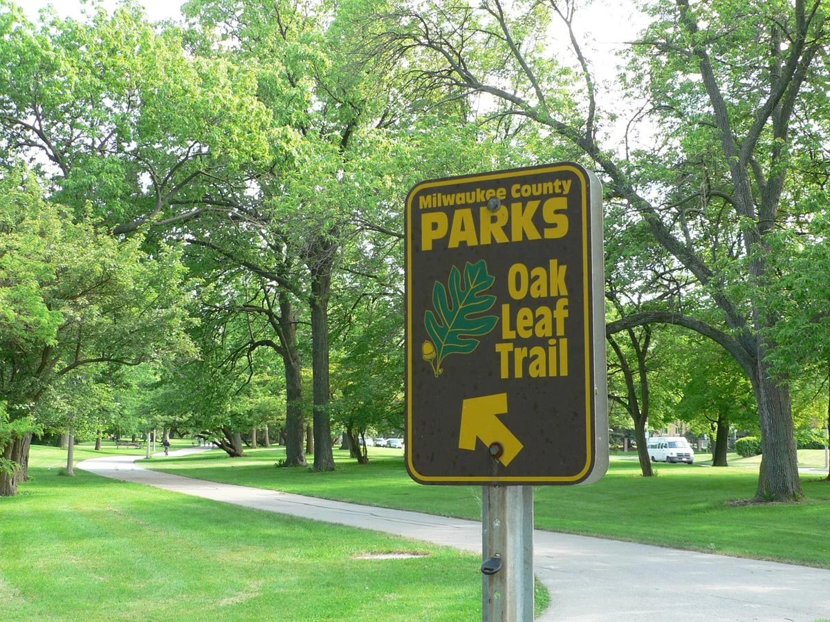
The changes extend beyond streets. Mequon’s new Highland Road Bike Spur connects the Ozaukee Interurban Trail with Rotary Park. Brown Deer’s new Ten Mile Park gives families another destination beside the Oak Leaf Trail.
Some projects address familiar problems: aging pavement, underground utilities and drainage. Others add recreation space or close gaps in walking and biking routes.
Taken together, they suggest a broader shift: communities are paying more attention to the entire trip—not just the road, intersection or park in isolation.
For families, the most useful questions are practical.
Can you cross with a child without rushing? Push a stroller through an intersection? Reach a playground by bike? Let an older child walk to school with more confidence?
Those questions help explain what the construction could accomplish, and what still needs attention.
Explore the North Shore’s Changing Streets, Trails & Parks
Find construction, completed improvements and future plans. Select a numbered pin or choose a project from the list below.
Snapshot: October 6, 2026. Pins mark intersections, park addresses or representative project areas—not exact construction boundaries. Check the linked sources for current access and schedules.
Loading map…
Dashed green line: approximate Highland Road spur corridor. Other corridors and village-wide plans use reference pins rather than route lines. A planned improvement does not indicate an open route or a final funded design.
Browse the projects shown on the map
Why Are So Many Projects Happening?
There isn’t one explanation for every construction zone.
Glendale says its Silver Spring corridor infrastructure is more than 25 years old and needs rehabilitation. Whitefish Bay’s Sendik’s redevelopment combines a new grocery store with surrounding public improvements. Shorewood’s Oakland reconstruction is rebuilding a major commercial corridor.
The opportunity comes when communities decide what to put back.
Replacing pavement can also create a chance to improve crossings, update curb ramps, reconsider street space and strengthen bicycle connections.
Shorewood made that approach explicit through its Complete Streets policy, adopted in August 2025. Its Complete Streets annual report describes a commitment to accommodating people of different ages and abilities who walk, use mobility devices, ride transit, bicycle or drive. Oakland’s design predates the policy but already includes several of those elements.
These projects are not one coordinated North Shore construction program. Each has its own scope, approvals, funding and schedule. But similar priorities are appearing across municipal boundaries.
Safer street crossings
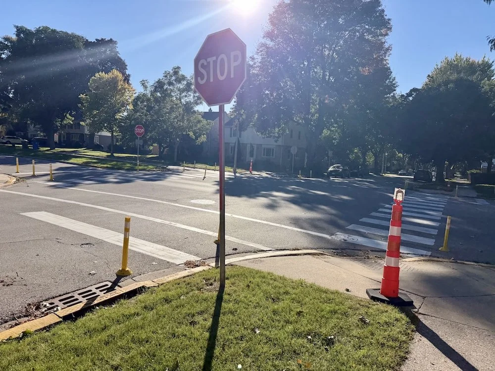
Street crossings at Richards Elementary School in Whitefish Bay
School routes bring these changes into focus. Children cross streets at predictable times, often alongside school buses, parent drop-offs and commuter traffic. Whitefish Bay and Shorewood are considering different ways to make those trips safer.
If you’ve noticed upright reflective posts near Whitefish Bay school crossings, those are temporary traffic-calming installations. They help the village test proposed layouts, evaluate vehicle turns and gather feedback before building permanent improvements.
The permanent project covers four intersections:
Santa Monica Boulevard and Belle Avenue: Bump-outs and intersection improvements near Richards Elementary.
Santa Monica Boulevard and Day Avenue: Bump-outs and intersection improvements near Richards Elementary.
Santa Monica Boulevard and Beaumont Avenue: Intersection improvements near St. Monica School.
Hampton Road and Ardmore Avenue: Bump-outs and intersection improvements near Cumberland Elementary.
Construction is planned for mid-June through late August 2027, during summer break. On October 5, the Village Board approved a $75,385 construction-administration contract for professional services to prepare for and oversee the work—not the full construction cost.
Read our Whitefish Bay school-crossing update for project details and ways to share feedback.
Shorewood’s recent discussion concerns another potential conflict: vehicles turning through crosswalks while children are walking to school.
A proposal would expand and standardize no-right-turn-on-red restrictions near schools, including removing “when pedestrians are present” language from some existing rules. Supporters argued that clearer restrictions could make expectations easier for drivers to understand.
At its September 21 meeting, however, the Public Works Committee held off on advancing the proposal separately. Officials and a crossing guard described drivers ignoring existing restrictions and questioned whether additional signs alone would sufficiently change behavior.
The committee favored examining the intersections through the broader Neighborhood Greenways planning process, alongside street design, enforcement, crossing guards and school drop-off patterns.
No new turn restrictions were adopted at that meeting. Drivers should continue following the signs currently posted. Our Shorewood no-right-on-red update explains the proposal and why the committee chose a broader review.
Together, these examples raise a practical question for families: does the entire school trip work comfortably—from the neighborhood sidewalk to the final crossing? Shorter crossings, clearer rules and calmer streets can each contribute, but their value depends on how drivers and pedestrians experience the finished route.
Streets Designed for Traffic Calming
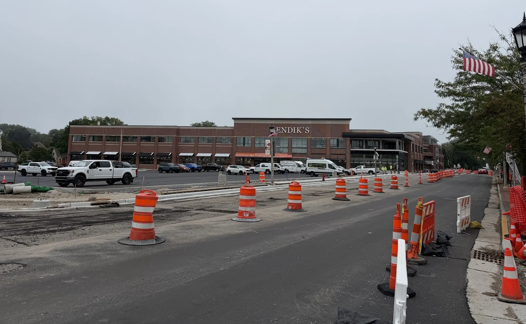
Around Whitefish Bay’s Sendik’s redevelopment, the village’s September updates identified completed curb extensions and a refuge median at Lake Drive and Beaumont Avenue. At Silver Spring and Hollywood Avenue, the refuge island and north-side extensions had been poured, with further work continuing.
The broader project includes pedestrian lighting, sidewalks, landscaping and a new signal at Consaul Place and Silver Spring. These changes extend beyond the grocery store’s property.
Our guide to what’s changing around Sendik’s and Silver Spring explains the individual intersections and construction stages. For current access restrictions, consult the village’s redevelopment updates.
A road can feel different even when it retains the same number of through lanes.
Medians, curb extensions and changes in how space is allocated can alter the experience of approaching an intersection. Narrowing a travel lane, shortening a crossing and removing a lane are different decisions; they shouldn’t all be described as the same thing.
Glendale’s published Silver Spring lane-width drawings illustrate proposed 11-foot travel lanes, compared with several wider existing lanes. The city labels the posted design information preliminary and subject to review.
The project’s planning materials also describe bicycle facilities, raised intersections and other traffic-calming measures. Our Glendale Silver Spring reconstruction guide explains the larger redesign.
Shorewood’s greenway planning considers tools such as traffic circles, medians, curb extensions and chicanes—features that introduce a bend or offset into a vehicle’s path.
The family benefit depends on how the finished street actually operates.
Federal guidance identifies speed management as an important part of reducing serious crashes. Lower speed limits can help, but communities also use street design, enforcement and other measures to encourage compliance.
That makes measured driving speeds after construction an important test of success.
Safer biking routes
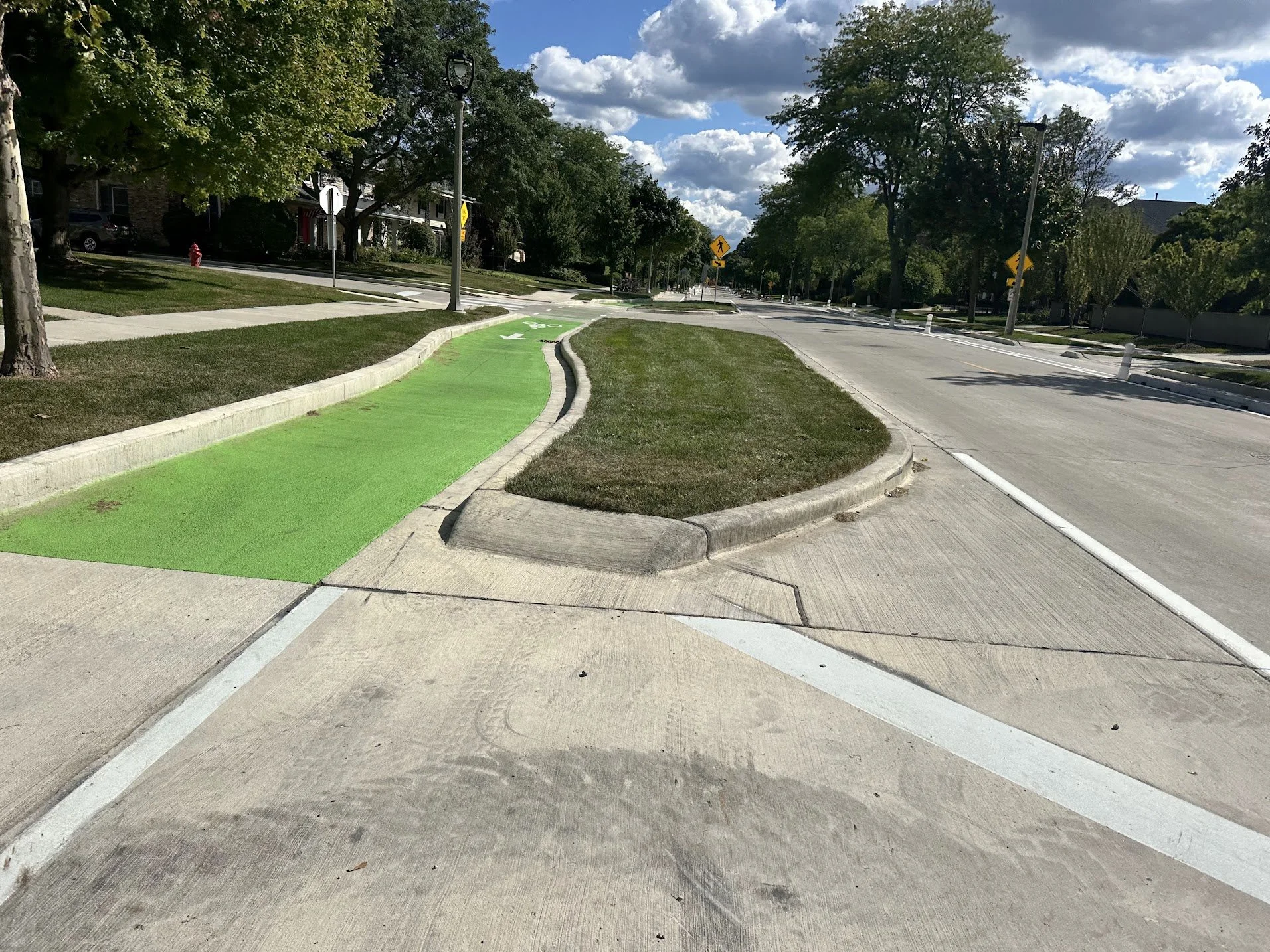
New bike lanes added to Lake Drive
Bicycle improvements are appearing in several forms.
Shorewood’s completed 2025 Lake Drive reconstruction included approximately 1.2 miles of painted bike lanes, curb extensions, pedestrian beacons and new streetlights. Oakland’s 2026 reconstruction also includes painted bike lanes, crossing improvements and upgraded accessible pedestrian signals.
Whitefish Bay lists bicycle lanes on Oakland Avenue and Wilson Drive among its recent bicycle and pedestrian improvements.
But a painted bike lane and a physically separated route offer different riding experiences. Paint marks dedicated space; it does not create a physical barrier between a bicycle and passing vehicles.
A parent assessing a route still needs to consider traffic speeds, turning vehicles, driveway crossings and what happens when the lane reaches an intersection.
The useful question is broader than whether a street has a bicycle symbol:
Does the whole trip feel manageable for this child?
Connecting Trails to Destinations
The Highland Road Bike Spur in Mequon offers another approach: an approximately 1.5-mile, 10-foot-wide paved path connecting the Ozaukee Interurban Trail with Rotary Park along the north side of Highland Road.
Instead of adding a bicycle lane within the roadway, it provides an off-road walking and biking connection.
The official opening celebration is scheduled for Sunday, October 18, from 4 to 5 p.m. at Rotary Park’s South Pavilion, 4100 W. Highland Road. Remarks begin at 4:15 p.m.; visitors should use the west entrance.
For families, the significance is the connection itself. A regional trail becomes more useful when it leads somewhere children want to go.
A bike ride can include a playground stop. A walk can begin at the park and continue toward the Interurban. Families gain an alternative to riding along Highland Road to bridge the gap.
Off-road does not mean conflict-free: intersections and driveways still require attention. But separating the path from through traffic changes the experience between those crossings.
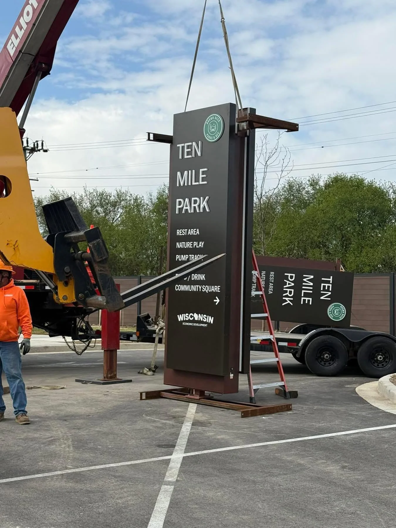
Ten Mile Park officially opened with a ribbon cutting on May 20, 2026
Brown Deer’s new Ten Mile Park shows the other side of that equation: building a destination beside an existing trail.
Despite its name, this is not a ten-mile-long park. It occupies approximately one acre at 4429 W. River Lane, beside the Oak Leaf Trail. The name recalls the historic Ten Mile Post Office and the area’s distance from downtown Milwaukee.
The village describes the project as a transformation of a former lumber-storage property into recreation space and a gateway to the trail’s Zip Line.
Its amenities include a bicycle pump track, pickleball courts and a nature-play area. The village’s summer 2026 update also describes restrooms, seating, signage, landscaping and other finishing work. Village records document a ribbon cutting on May 20, 2026.
The family benefit is easy to picture: a place to stop during a ride, let children play and take a break before continuing.
Our Oak Leaf Trail guide can help families explore the broader network. Brown Deer’s Parks and Recreation Department provides information about local facilities and programming.
Neighborhood Greenways
Not every useful connection requires an entirely new trail. Shorewood’s proposed neighborhood greenways focus on quieter residential streets. The village describes routes intended to prioritize walking, bicycling and other small mobility devices through signs, markings and traffic calming.
The potential benefit is a network that connects everyday destinations without requiring every bicycle trip to follow a busy commercial street.
Our Shorewood greenway update explains the proposed network and 27 potential intersection projects.
Those locations should not be mistaken for approved, funded construction. The official Neighborhood Greenways and Traffic Calming Program remains the place to follow recommendations and public participation opportunities.
The distinction matters: a painted bike lane, a neighborhood greenway and an off-road trail are different tools. A useful network may need all three.
More Projects in Glendale, Fox Point and Bayside
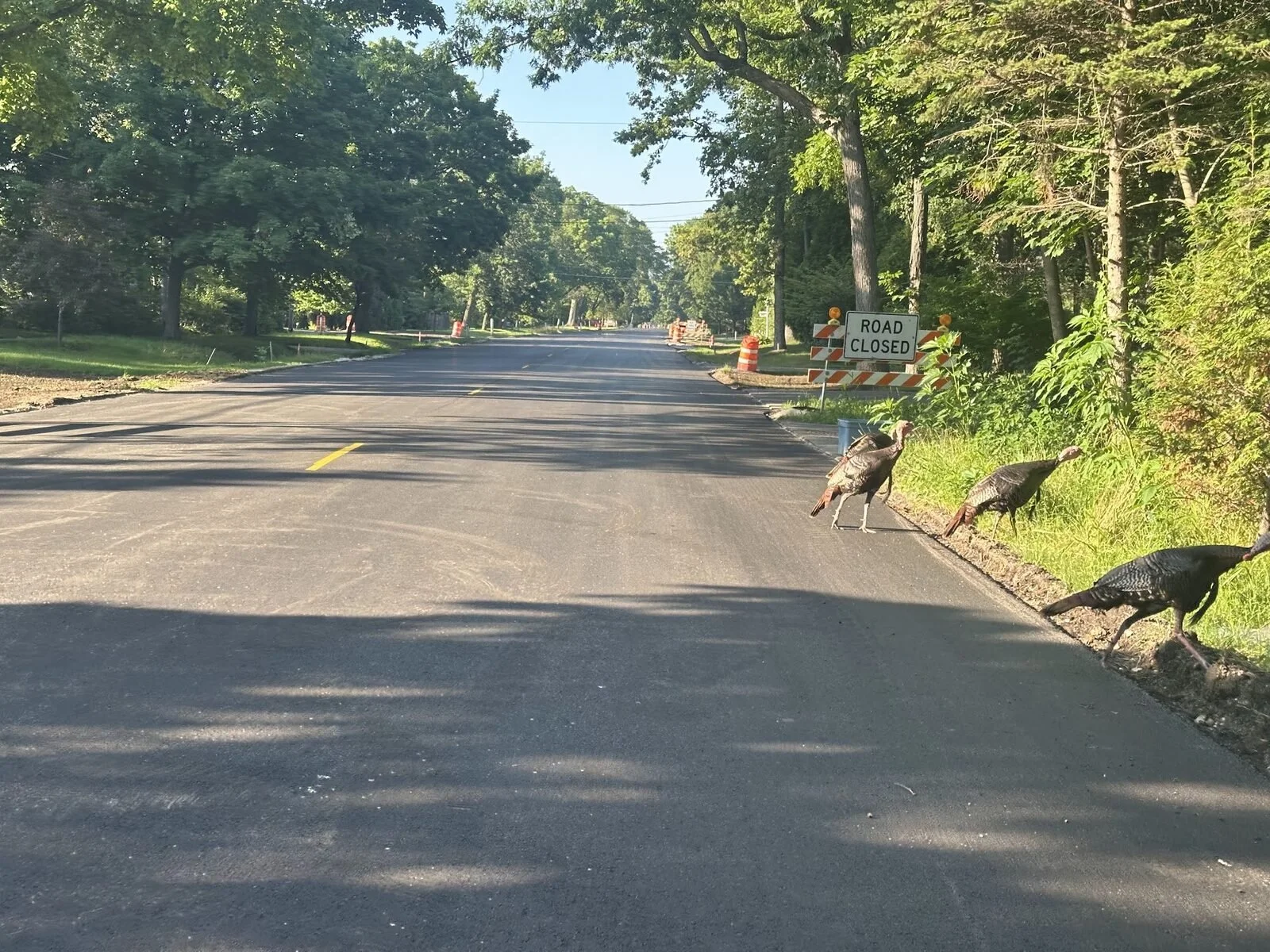
Even the turkeys checked out Fox Point’s Lake Drive construction in summer 2025. The project added flashing pedestrian crossings, accessibility improvements and upgraded utilities.
Fox Point’s completed Lake Drive project shows what these improvements can look like once the construction cones disappear.
The corridor between School Road and Dean Road reopened November 6, 2025. Along with pavement, water-main and drainage work, the project improved sidewalks for accessibility and added bicycle lanes at intersections.
A particularly visible change is the addition of pedestrian-activated flashing beacons at six Lake Drive intersections: Barnett Lane, Green Tree Road, Bridge Lane, Beach Drive, Fox Lane and Dean Road.
These rectangular rapid flashing beacons, often called RRFBs, draw drivers’ attention to people crossing. They are a different tool from Whitefish Bay’s curb extensions or Shorewood’s proposed turning restrictions, but address the same everyday concern: how to cross a busy road more comfortably.
The crossings also illustrate why a street project can accomplish more than smoother pavement. Underground repairs, accessible sidewalks and pedestrian improvements can be delivered together.
Our Lake Drive reopening article explains the changes, while the village’s completion announcement lists the finished improvements.
The same pattern extends into other North Shore communities: road projects are creating opportunities to improve walking access and connect neighborhoods with recreation destinations.
In Glendale, WisDOT’s proposed Green Bay Avenue reconstruction between Silver Spring Drive and Good Hope Road would replace the existing five-foot sidewalk on the east side with a ten-foot shared-use path connecting to the Oak Leaf Trail. Pedestrian curb-ramp upgrades and traffic-signal replacements are also planned. Construction is anticipated for 2029. For families, the potential benefit is more room to walk and bicycle along a corridor bordering Kletzsch Park.
A separate Green Bay Avenue project north of Good Hope Road is evaluating a new sidewalk/path connection to Brown Deer Park. WisDOT lists construction as early as 2027 if funding is available. This could help address a familiar obstacle: a park may be nearby, but reaching it without a car can still be difficult.
In Fox Point, the 2026 Beach Drive hill project combines road reconstruction with pedestrian-path replacement, stormwater improvements and a new retaining wall. It illustrates how walking access depends on drainage and stable surrounding infrastructure. Families should check the village’s project updates before using the route, because pedestrian access is restricted during construction.
Bayside’s proposed WIS 32 improvements between Dean Road and Mohawk Road include updated curb ramps and a concrete safety island separating the roadway from the existing asphalt sidewalk along the east-west section. Construction is scheduled for 2029, potentially 2028 if funding becomes available. These are future improvements, but they show how even a resurfacing project can create an opportunity to reconsider pedestrian space.
What Is Happening Beneath the Street?
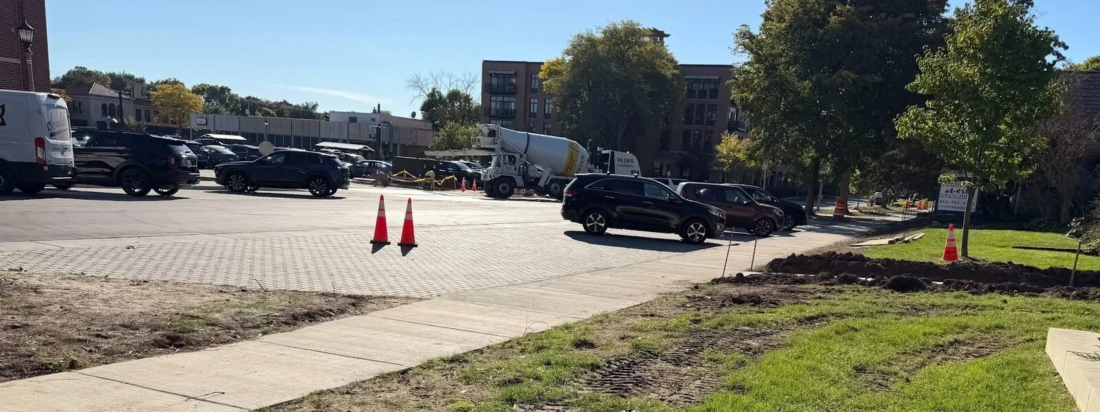
Porous pavement systems next to Sendik’s
Some of the changes are happening beneath the surface.
The permeable parking pavers on Beaumont Avenue, between Consaul Place and Lake Drive, serve a purpose beyond appearance. Water can pass through the pavement into a stone reservoir underneath, temporarily storing rainfall instead of sending it immediately into the storm sewer.
According to the village’s engineering plans, that underground storage has an estimated capacity of 62,000 gallons during typical storm events. The village describes the system as capturing the first half-inch of rainfall on Beaumont, helping reduce the amount of runoff and how quickly it reaches the drainage system.
Ordinary asphalt sends rainwater across its surface toward gutters and drains. Permeable pavement gives that water a path downward.
MMSD explains that porous pavement systems use engineered stone layers beneath the surface to hold water temporarily. Depending on the design, the water then slowly enters the soil or drains into the storm sewer. That slower release helps manage runoff and can reduce the pollution carried into local waterways.
On Beaumont, the pavers complement a larger drainage improvement: a new 24-inch storm sewer and additional inlets. The underground reservoir handles local rainfall, while the sewer improvements help move water from the larger drainage area. Together, they add capacity, although they cannot prevent every flood during an extreme storm.
The parking area already needed full-depth reconstruction. Village staff identified that work as a practical opportunity to install the stone storage system, rather than tearing up finished pavement for a later retrofit.
For families visiting Silver Spring, the most noticeable changes may be the parking layout, sidewalks and crossings. The pavers offer another detail to look for: an everyday parking space that also helps manage rainwater.
Read more about what’s still changing around Sendik’s and Silver Spring.
Who Is Paying for This?
There isn’t one North Shore funding source. These projects use different combinations of municipal funding, federal grants, regional programs, private development and community fundraising. Some involve public-private collaboration; others are primarily publicly funded projects.
Private Redevelopment Alongside Public Improvements
Whitefish Bay describes the Sendik’s redevelopment as a $10 million project accompanied by substantial public infrastructure work.
The village lists nearly $925,000 in bicycle and pedestrian safety improvements and $2.2 million in broader infrastructure enhancements, including sidewalks, curbs, stormwater work, resurfacing and a new signal.
Those figures should not be described as a private donation from Sendik’s for road construction. The store redevelopment and the surrounding public improvements are related but distinct parts of the larger effort.
A specific example is Beaumont’s permeable parking. The village’s May 4 engineering memo proposed covering the $160,000 added cost with $100,000 from the Milwaukee Metropolitan Sewerage District’s Green Infrastructure Partnership Program and $60,000 from Tax Incremental District No. 1 contingency funds.
That is a targeted stormwater-funding package within a larger redevelopment project.
Nonprofit-Led Project with Federal and Community Support
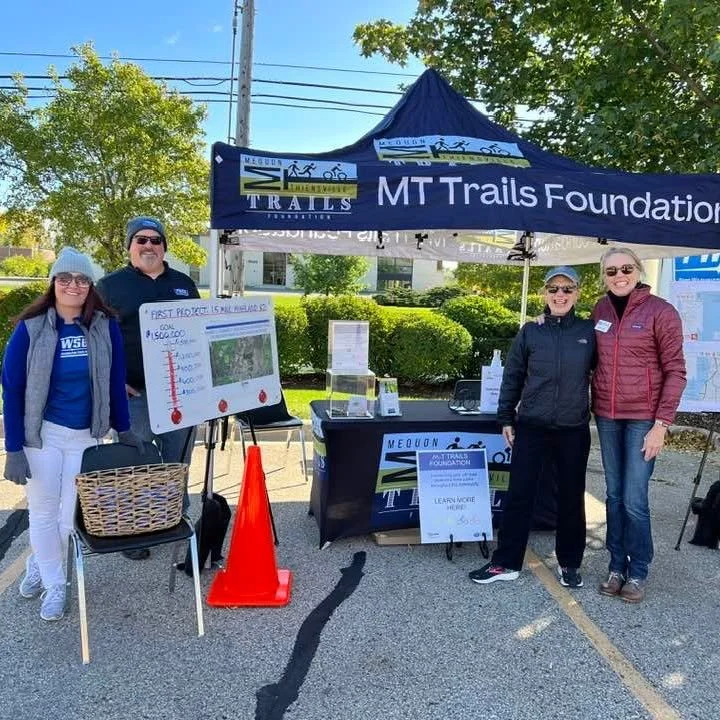
Mequon’s spur illustrates a different model.
MT Trails Foundation organized the project, worked with local government and residents, and secured a $988,000 federal grant administered through WisDOT.
Its published budget identifies approximately $1.2 million to develop and construct the path, plus a $100,000 maintenance endowment. Community donations and grants complement the federal award.
The foundation continues fundraising for long-term trail maintenance, estimating that the fully funded endowment would provide approximately $5,000 annually for upkeep.
This is nonprofit leadership combined with government funding, local coordination and private giving—not an entirely privately funded trail.
Federal Funding for a Local Recreation Space
Brown Deer reported securing $2,496,630 through the 2023 federal Community Project Funding process for Ten Mile Park.
The village’s summer 2026 account says the federal appropriation covered the park’s design and construction costs.
That funding did not eliminate budget constraints. Initial bids came in too high, and the village revised the design, replacing a proposed skateboard plaza with pickleball courts before rebidding.
The project shows both what a grant can make possible and why communities still have to adjust plans to available dollars. See the village’s funding announcement and planning background.
Glendale’s Silver Spring: Federal Awards and a Local Share
Glendale’s October 2024 project presentation outlined an approximately $12 million construction budget supported by roughly $8 million in federal funding and $4 million in local funding.
The local portion was divided between Glendale and Milwaukee, with Glendale responsible for 70% and Milwaukee 30%.
Those are planning-era budget figures, not a final accounting of completed construction. But they demonstrate how multiple governments can share responsibility for a corridor that crosses jurisdictional boundaries.
Whitefish Bay School Crossings: A Grant Plus District and Village Funds
For the school-crossing project, the village identifies $922,600 in available funding:
$497,600 from a WisDOT Transportation Alternatives Program grant.
$200,000 from Tax Incremental District No. 3.
$225,000 in village funding.
The construction estimate is separate from the overall available funding and professional-service costs.
This is another reason to be careful with project numbers: a grant award, construction estimate, engineering contract and total funding package describe different things.’
Federal Grants: Crossings and Trail Bridges
Some improvements reach across municipal boundaries.
In August 2026, Milwaukee County announced nearly $3 million in federal Transportation Alternatives Program funding. Approximately $2 million will support improvements at nine priority bicycle and pedestrian crossings across five communities, including Glendale, Fox Point and Bayside.
Another approximately $1 million will help replace two Oak Leaf Trail bridges over I-43 and Port Washington Road near the eastern end of Lincoln Park, north of Hampton Avenue. Built in 1936, the bridges have growing maintenance needs.
The county says project timing will be determined with WisDOT. The awards are contributions toward the work, rather than a statement that every project’s full cost is covered.
For families, these investments address two essential parts of a useful network: crossing roads between trail segments and keeping existing connections available for future walks and bicycle rides. Building new paths matters, but maintaining the bridges and crossings that join them is just as important.
Community Connections
Imagine walking to school, continuing to the library and stopping at a store without encountering one crossing that makes the trip feel impractical.
Or picture a bicycle trip to Estabrook Park where reaching the trail feels as manageable as riding on it.
The Highland Road spur and Ten Mile Park illustrate complementary pieces of that network: one connects a trail to a park; the other adds a park beside a trail.
Longer-range projects could add more destinations. Mequon Commons’ 30-year plan considers the future of the civic campus, while Riverview Park’s playground planning raises questions about accessibility and recreation.
Those projects are at different stages. A long-term plan is not a promise that every feature is funded or ready for construction.
The larger opportunity is more everyday trips that families can realistically make on foot or by bike—including errands and visits to Shorewood’s restaurants and cafés.
But one difficult intersection, missing sidewalk or abrupt bicycle-lane ending can remain a major obstacle.
An improved intersection is valuable. An intentionally-designed route can shape a community’s identity.
If it feels like every trip around Milwaukee’s North Shore involves construction cones lately, there’s a reason.