

The Ultimate Guide to Seeing Fall Colors in Wisconsin
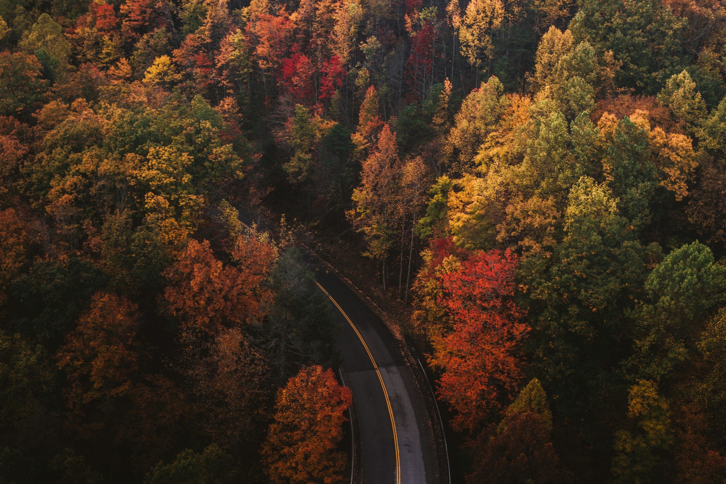
Wisconsin does fall color exceptionally well. Lake Superior cliffs glow with birch and maple, Northwoods lakes mirror red-and-gold forests, Door County roads wind beneath leafy canopies, and the Driftless Region’s bluffs rise above the Mississippi River.
The challenge is not finding fall color. It is choosing among hundreds of worthwhile places—and arriving at the right time.
This guide organizes Wisconsin’s best fall-color experiences by region and by how you want to explore: hiking, biking, driving, paddling, boating, climbing an observation tower or simply finding an easy overlook with the family.
Before leaving home, check the official Wisconsin Fall Color Report. Local reporters update color progress and predicted peak timing around the state throughout the season.
Wisconsin Fall Color Adventure Map
Explore all 68 destinations. Combine activities, then narrow the map by region or trip feature.
When Do Fall Colors Peak in Wisconsin?
Wisconsin’s color season generally moves from north to south, beginning in northern Wisconsin around mid-September and continuing through southern Wisconsin into late October. However, there is no guaranteed “peak weekend.”
Temperature, rainfall, drought, wind, elevation, tree species and proximity to Lake Michigan or Lake Superior can all influence timing. A storm can also strip colorful leaves from exposed trees surprisingly quickly.
As a general planning window:
Lake Superior, far northern Wisconsin and the Northwoods: Mid-September through early October
North-central and central Wisconsin: Late September through mid-October
Door County and northeastern Wisconsin: Late September through mid-October
Western Wisconsin and the Driftless Region: Late September through mid-October
Madison, the Wisconsin River and south-central Wisconsin: Early through late October
Milwaukee, southeastern Wisconsin and Lake Michigan: Early through late October
Treat these as broad planning ranges, not predictions. Check the statewide report immediately before your trip and keep a backup destination slightly north or south of your original choice.
Wisconsin’s Best Fall-Color Experiences
Best scenic drives
Wisconsin Great River Road
Lake Superior National Scenic Byway
Door County Coastal Byway
Lower Wisconsin River Road
Kettle Moraine Scenic Drive
Rustic Roads through Oconto and Marinette counties
Highway 13 around the Bayfield Peninsula
Highway 55 through Forest County
Highway 33 through the Baraboo Hills
Highway 60 from Lodi to Prairie du Chien
Best fall hikes
Devil’s Lake State Park
Copper Falls State Park
Peninsula State Park
Perrot State Park
Wyalusing State Park
Rib Mountain State Park
Governor Dodge State Park
Kettle Moraine State Forest
St. Peter’s Dome
Wildcat Mountain State Park
Best bike rides
Sunset Bike Trail at Peninsula State Park
Great River State Trail
Elroy-Sparta State Trail
Bearskin State Trail
Red Cedar State Trail
Ahnapee State Trail
Glacial Drumlin State Trail
Mountain-Bay State Trail
Old Abe State Trail
Kettle Moraine mountain-bike trails
Best overlooks and towers
Timm’s Hill
Rib Mountain
Eagle Tower at Peninsula State Park
Grandad Bluff
Wyalusing State Park
Holy Hill
Lapham Peak
Gibraltar Rock
Blue Mound State Park
Hoffman Hills State Recreation Area
Best color from the water
Apostle Islands cruises
Sister Bay and Ephraim boat tours
Lake Minocqua
Manitowish Waters Chain of Lakes
Wisconsin River
Mississippi River
Mirror Lake
Lake Mendota
Namekagon River
Chippewa Flowage
Best for families with younger children
Eagle Tower at Peninsula State Park
Holy Hill grounds
Pike Lake
Horicon Marsh
Mirror Lake State Park
Lake Geneva Shore Path
Bayfield lakeshore
Lake Mendota and the UW–Madison Lakeshore Path
Schlitz Audubon Nature Center
Wehr Nature Center
Best places to avoid the biggest crowds
Oconto County back roads
Highway 55 through Forest County
Governor Thompson State Park
Brunet Island State Park
Roche-A-Cri State Park
Straight Lake State Park
Wildcat Mountain State Park
Black River State Forest
Northern Door County Land Trust preserves
Rustic Roads away from Wisconsin’s major tourist towns
Lake Superior, Bayfield and Northwestern Wisconsin
Northern Wisconsin usually begins changing first. This is the region to watch when September nights become noticeably cooler but much of southern Wisconsin remains green.
Its signature combination is difficult to beat: brilliant hardwood forests, sandstone cliffs, waterfalls and the deep blue water of Lake Superior.
Bayfield Peninsula and Highway 13
The Lake Superior National Scenic Byway follows approximately 70 miles of Lake Superior shoreline around the Bayfield Peninsula. Highway 13 carries drivers past forest, orchards, small communities and frequent opportunities to see the lake.
Start near Ashland, continue through Washburn and Bayfield, and follow the peninsula toward Red Cliff and Cornucopia. Bayfield’s hills create beautiful combinations of rooftops, church steeples, islands and fall color.
Best for: Driving, photography, couples, orchards and Lake Superior views
Apostle Islands by boat
Viewing the Apostle Islands from the water adds red and gold shoreline forests to the sea caves, historic lighthouses and Lake Superior cliffs. Cruise schedules are seasonal and weather-dependent, so verify current trips before planning a late-season outing.
Best for: Boat tours, photography and a memorable splurge
Copper Falls State Park
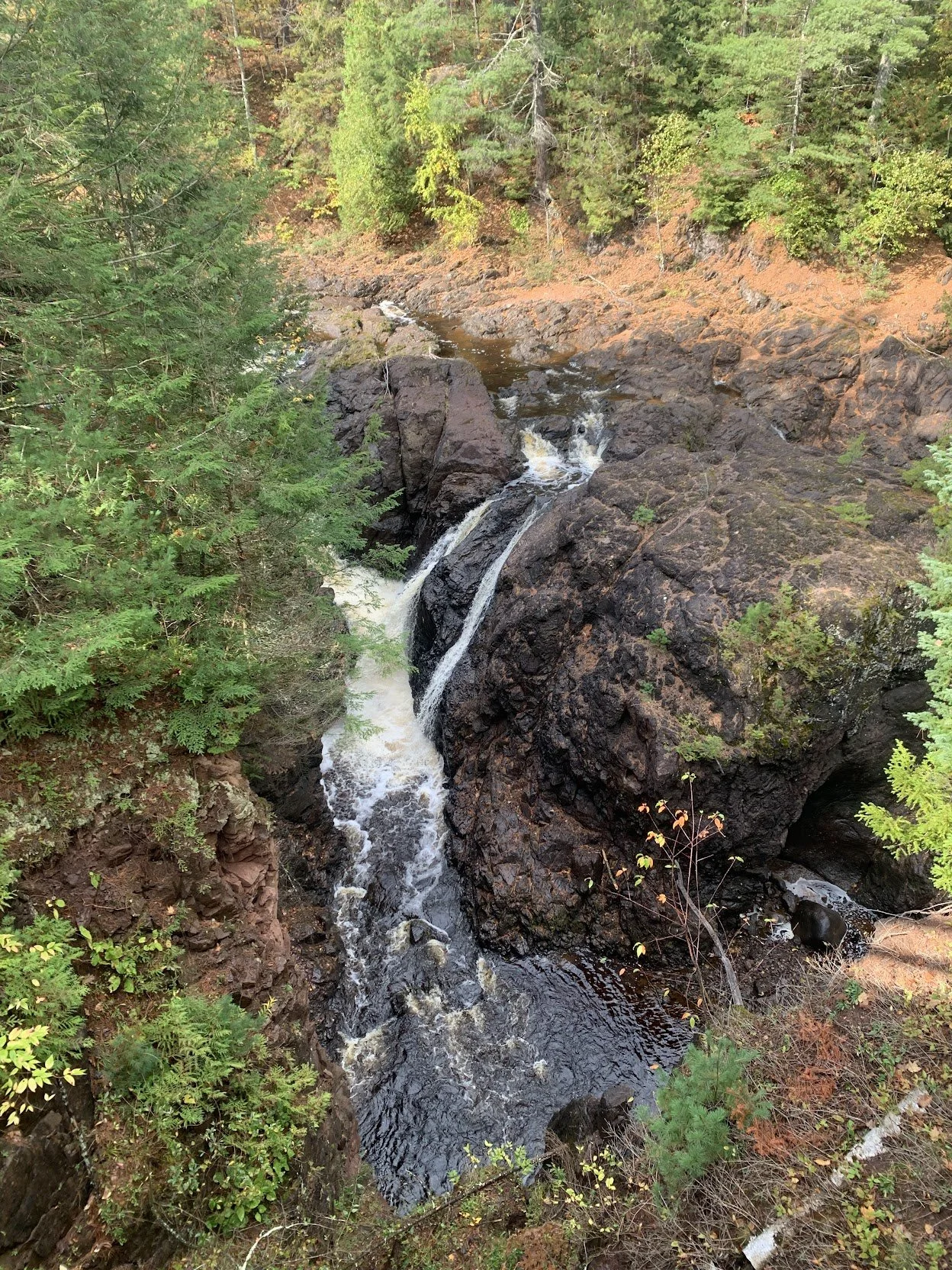
Near Mellen, Copper Falls State Park combines hardwood forest, ancient lava flows, waterfalls and the gorge of the Bad River. The 1.7-mile Doughboys Nature Trail is one of Wisconsin’s most rewarding short hikes, particularly when colored leaves frame Copper and Brownstone falls.
Expect stairs, roots, elevation changes and potentially slippery surfaces near the gorge.
Best for: Waterfalls, hiking, photography and active families
St. Peter’s Dome and Morgan Falls
The St. Peter’s Dome area in the Chequamegon-Nicolet National Forest pairs two very different experiences. Morgan Falls is the easier scenic destination, while the climb to St. Peter’s Dome leads to an expansive overlook across forested northern Wisconsin.
Trail conditions can be rugged, and the final approach to the overlook is not an easy family stroll.
Best for: Big views and experienced hikers
Pattison and Amnicon Falls state parks
South of Superior, Pattison State Park features Big Manitou Falls, Wisconsin’s tallest waterfall. Nearby Amnicon Falls State Park surrounds a series of smaller waterfalls and rocky river channels. Both are excellent additions to a Lake Superior road trip.
Best for: Waterfall chasing, short walks and families
Great Divide and North Country Trail country
The North Country National Scenic Trail crosses some of Wisconsin’s wildest northern terrain. The sections around the Chequamegon-Nicolet National Forest provide an immersive forest experience without the concentration of visitors found at the best-known state parks.
Wear blaze orange during hunting seasons and consult current trail and public-land maps before heading into remote areas.
Best for: Solitude, backpacking and serious hiking
Northwoods and Northeastern Wisconsin
The Northwoods offers the quintessential Wisconsin fall scene: a calm lake surrounded by red maples, golden birches and dark evergreens. Minocqua, Boulder Junction, Presque Isle and Manitowish Waters all make useful bases for a fall weekend.
Minocqua, Boulder Junction and Presque Isle
Rather than planning a single attraction, make the drive part of the experience. Connect lake roads, forest highways and small towns around Oneida and Vilas counties, stopping at public boat landings and trailheads as color conditions dictate.
The Bearskin State Trail begins in Minocqua and follows a former rail corridor through forests and wetlands. Boulder Junction’s extensive paved trail system provides another family-friendly way to explore without staying on busy highways.
Best for: Cabins, biking, lake views, paddling and flexible road trips
Northern Highland–American Legion State Forest
Wisconsin’s largest state forest contains hundreds of lakes and extensive opportunities for hiking, biking, paddling and camping. The Raven, Escanaba, Madeline and McNaughton trail systems make it possible to choose anything from a short woodland walk to a longer ride.
Best for: A complete Northwoods weekend
Manitowish Waters Chain of Lakes
The Manitowish Waters area is especially beautiful from the water. A kayak or canoe puts the color at eye level and creates reflections that can double the effect on a calm morning.
Use public launches, wear a life jacket and plan conservatively for cold water and rapidly changing autumn weather.
Best for: Paddling and peaceful lake views
Timm’s Hill
At 1,951.5 feet above sea level, Timm’s Hill is Wisconsin’s highest natural point. An observation tower rises above the trees and provides a broad view over Price County’s forest and lakes.
The surrounding Timm’s Hill Trail also connects with the Ice Age Trail, giving visitors the option of seeing the view and then exploring the woods on foot.
Best for: Observation-tower views and Wisconsin bucket lists
Rib Mountain State Park
Rib Mountain State Park rises above the Wausau area and provides one of central Wisconsin’s most recognizable fall panoramas. Hiking trails and overlooks reveal miles of forest, farms and communities.
Granite Peak sometimes offers seasonal chairlift rides, but dates, tickets and operating conditions change annually. Check directly with the ski area before making the chairlift the centerpiece of your trip.
Best for: Hiking, panoramic views and an easy Wausau weekend
Oconto County and Highway 55
Oconto County is one of the most frequently overlooked fall destinations in Wisconsin. Forest roads, the Oconto River, Chute Pond and the Mountain-Bay State Trail provide scenery without the crowds associated with Door County or Minocqua.
Farther north, Highway 55 between the Crandon area and the Michigan border travels through a heavily forested landscape. Build in time for public parks, river overlooks and short walks rather than treating it merely as a route to somewhere else.
Best for: Quiet drives, biking and uncrowded forest scenery
Marinette County waterfall country
Marinette County promotes itself as Wisconsin’s waterfall capital, and its self-guided fall color driving tour links waterfalls, parks, scenic overlooks and Rustic Roads.
Possible stops include Dave’s Falls, Long Slide Falls, Twelve Foot Falls and Strong Falls. Some waterfalls require hiking over rocky or uneven terrain.
Best for: Waterfalls, scenic drives and full-day adventures
Door County and the Lake Michigan Peninsula
Door County combines wooded parks, orchards, limestone bluffs, shoreline villages and water views. Color can develop differently along the Green Bay and Lake Michigan sides, so the peninsula often provides options even when one area is past peak.
Weekends can be extremely busy. Visit on a weekday, start early and avoid stopping in travel lanes for photographs.
Explore Door County & the Lake Michigan Peninsula
Combine activities, choose an optional feature and discover your fall adventure.
Peninsula State Park
Peninsula State Park may be Wisconsin’s most complete fall-color destination. Visitors can hike, bike, drive scenic interior roads, golf, picnic beside Green Bay and climb Eagle Tower.
The accessible ramp to Eagle Tower makes its elevated view available to many visitors who cannot climb a traditional observation tower. The Sunset Bike Trail provides a roughly nine-mile limestone route through the park, while more challenging hiking trails reach shoreline bluffs and forest overlooks.
Best for: First-time Door County visitors, families, biking and accessible views
Northern Door County scenic drive
From Sister Bay, follow the Door County Coastal Byway north toward Ellison Bay, Gills Rock and Northport. Old Stage Road provides a quieter wooded alternative for part of the journey.
Near the tip of the peninsula, the famous curving section of Highway 42—often called the Jens Jensen Winding Road—is a popular photograph. Use a safe pull-off and never stand in the traffic lane.
Best for: Driving, photography and classic Door County scenery
Newport State Park
Newport State Park protects a quiet stretch of the Lake Michigan shoreline near Ellison Bay. Its trails pass through forest, wetlands and shoreline environments, and the park’s distance from Door County’s busiest villages creates a more peaceful experience.
Newport is also Wisconsin’s first designated International Dark Sky Park, making it possible to pair an afternoon fall hike with an evening of stargazing.
Best for: Hiking, solitude and sunset-to-stargazing outings
Potawatomi State Park
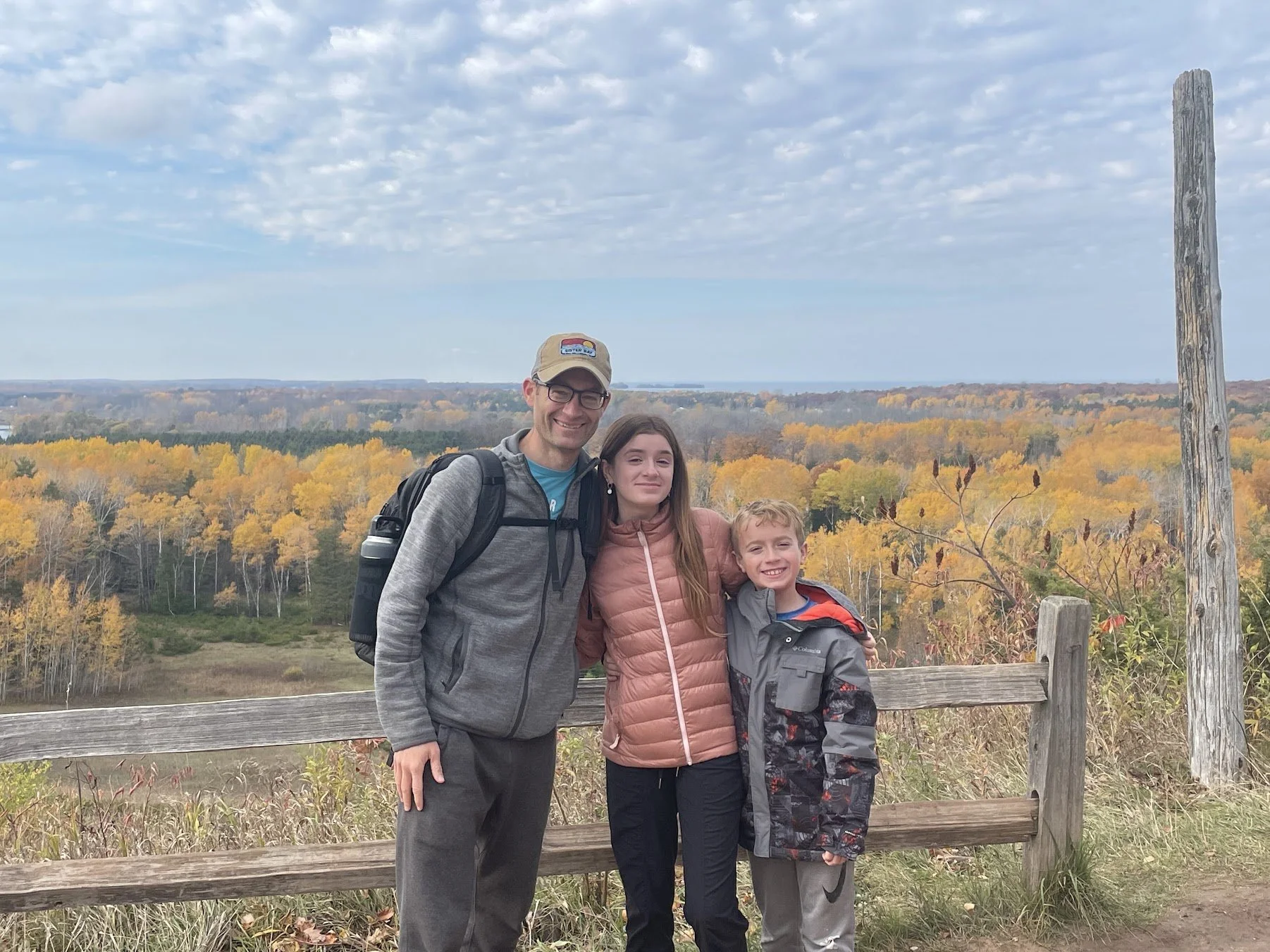
Near Sturgeon Bay, Potawatomi State Park provides forested trails and views of Sturgeon Bay and Green Bay. It can be a practical alternative when northern Door County is especially crowded.
Best for: Hiking, biking and a convenient southern Door County stop
Whitefish Dunes and Cave Point
Whitefish Dunes State Park and adjacent Cave Point County Park combine colored hardwoods with Lake Michigan waves, limestone shelves and rocky shoreline. This is less about an uninterrupted forest panorama and more about the contrast between leaves, stone and blue-green water.
Stay well back from cliff edges and wet rocks, especially when waves are strong.
Best for: Shoreline photography, shorter walks and dramatic water views
Door County from the water
A fall boat tour offers a different view of Eagle Bluff, Chambers Island, shoreline cottages and forested bluffs. Sister Bay Scenic Boat Tours is one option for seeing the peninsula from Green Bay.
Trips are seasonal and weather-dependent. Confirm the exact route, departure location and schedule before traveling.
Best for: Families, couples and people who prefer not to hike
Door County Land Trust preserves
Door County Land Trust properties offer quieter alternatives to the peninsula’s major parks. Preserve rules, parking capacity and trail conditions vary, so choose a property through the organization’s current preserve directory before visiting.
Oak Road Nature Preserve, mentioned by local fall travelers, protects forest and wetland habitat in northern Door County.
Best for: Birding, quiet walks and nature-focused outings
Central Wisconsin and the Wisconsin River
Central Wisconsin’s mix of granite hills, river valleys, pine forest and hardwoods produces landscapes that feel distinctly different from both the Northwoods and Driftless Region.
Dells of the Eau Claire
The Dells of the Eau Claire County Park east of Wausau follows the Eau Claire River through rock formations, rapids and wooded trails. The Ice Age Trail passes through the property, creating several options for a short walk or more ambitious hike.
Wet rocks can be dangerously slippery, and visitors should remain on established trails.
Best for: River scenery, geology and family hiking
Stevens Point and the Green Circle Trail
The Green Circle Trail loops through parks, neighborhoods, forest and riverfront landscapes around Stevens Point. Because it passes through multiple environments, it works well for walkers and bicyclists who want fall color without committing to a remote trail.
Best for: Urban biking, walking and flexible distances
Roche-A-Cri State Park
Roche-A-Cri centers on a striking 300-foot rock outcrop. A stairway leads toward the top, while ground-level trails provide alternatives for visitors who do not want the climb.
The elevated view across central Wisconsin can be especially impressive during peak color. Confirm current stair and trail access before visiting.
Best for: Unusual geology and elevated views
Buckhorn State Park and the Castle Rock area
Buckhorn State Park sits on a peninsula in the Castle Rock Flowage. Its combination of oak forest, water and wetlands creates a quieter fall experience than the Wisconsin Dells attractions farther south.
Best for: Camping, paddling, accessible recreation and quiet shorelines
Hills west of Mauston
The landscape west of Mauston begins transitioning into the Driftless Region. County highways and rural roads reveal wooded ridges, farms and small valleys that are easy to miss from the interstate.
Combine the drive with Wildcat Mountain, the Elroy-Sparta State Trail or the Kickapoo Valley Reserve.
Best for: Back-road wandering and photography
Western Wisconsin and the Driftless Region
The Driftless Region escaped the flattening effects of the most recent glaciers. The result is a landscape of steep wooded ridges, narrow valleys, limestone cliffs and winding rivers.
This is one of the best parts of Wisconsin for a fall road trip because the scenery changes continuously with every curve and elevation change.
Wisconsin Great River Road
The Wisconsin Great River Road follows the Mississippi River for approximately 250 miles through more than 30 communities.
A particularly scenic stretch connects La Crosse, Trempealeau, Alma, Pepin and Maiden Rock. Pull into designated overlooks rather than stopping on narrow shoulders.
Best for: Multi-day road trips, river towns and bluff views
Grandad Bluff
Grandad Bluff rises above La Crosse and provides a wide view of the city, Mississippi River and surrounding bluffs. Because visitors can drive near the overlook, it delivers an impressive payoff without a long hike.
Best for: Easy panoramic views, sunrise and sunset
Perrot State Park
Perrot State Park sits among river bluffs near Trempealeau. Trails climb to overlooks above the Mississippi and Trempealeau rivers, while lower routes explore forest, wetlands and shoreline.
Brady’s Bluff offers the signature view but requires a substantial climb.
Best for: Bluff hiking, birding and Mississippi River views
Great River State Trail
The Great River State Trail passes through river-bottom forest and wetlands near the Mississippi. Its generally gentle rail-trail grade makes it a more approachable fall ride than the steep roads climbing the surrounding bluffs.
Best for: Family biking and longer recreational rides
Fountain City, Alma and Lake Pepin
Fountain City sits between steep wooded bluffs and the Mississippi River. Alma’s riverfront setting and elevated Buena Vista Park overlook make it another rewarding stop.
Continue north beside Lake Pepin toward Pepin, Stockholm and Maiden Rock for one of Wisconsin’s most scenic combinations of water, bluffs and small towns.
Best for: Scenic driving, overlooks and river-town stops
Viroqua, Westby and the Kickapoo Valley
Viroqua and Westby make excellent bases for exploring Vernon County. The best color is often found along the winding county roads between ridges and valleys rather than at a single landmark.
The Kickapoo Valley Reserve and nearby Wildcat Mountain State Park offer hiking, paddling and overlooks in the heart of the region.
Best for: Back roads, farm scenery, hiking and paddling
Richland Center area
The hills surrounding Richland Center deliver classic Driftless scenery with fewer visitors than La Crosse or the Baraboo area. Highway 60, Highway 80 and connecting county roads reveal wooded ridges, farmland and the Wisconsin River valley.
Best for: Low-key scenic drives and exploring without a strict itinerary
Wyalusing State Park
At Wyalusing State Park, visitors can stand approximately 500 feet above the confluence of the Wisconsin and Mississippi rivers. Bluff-top overlooks, wooded hiking trails and camping make it one of southern Wisconsin’s strongest fall destinations.
Best for: Major overlooks, hiking and camping
Elroy-Sparta and “400” state trails
The Elroy-Sparta State Trail travels 32 miles along a former railroad route and passes through three historic tunnels. The nearby “400” State Trail follows the Baraboo River between Reedsburg and Elroy.
Trail passes may be required for riders age 16 and older. Bring a light for tunnels and check seasonal trail conditions.
Best for: Rail-trail biking and full-day rides
Baraboo, Madison and South-Central Wisconsin
This region usually colors later than northern Wisconsin, giving travelers another opportunity after Northwoods leaves have begun to fall.
Devil’s Lake State Park
Devil’s Lake State Park surrounds a lake framed by quartzite bluffs rising roughly 500 feet above the water. The East Bluff and West Bluff trails provide iconic views, but both involve steep sections, rocks and elevation.
For an easier outing, walk near the lake or explore the relatively gentle trails around Steinke Basin. Arrive early on peak fall weekends because parking areas can fill.
Best for: Wisconsin’s most dramatic fall hike
Highway 33 and the Baraboo Hills
Highway 33 passes through the Baraboo area and climbs through forested hills toward Wildcat Mountain and the Driftless Region. Combine it with Devil’s Lake, Mirror Lake or the quieter roads around Rock Springs and La Valle.
Best for: Scenic driving with several park options
Mirror Lake State Park
Mirror Lake is surrounded by sandstone cliffs and wooded shoreline. Its relatively calm, protected water creates particularly attractive reflections on still autumn mornings.
The park offers hiking, biking and paddling without the imposing bluff climbs at nearby Devil’s Lake.
Best for: Paddling, families and peaceful forest walks
Governor Dodge State Park
Governor Dodge State Park covers more than 5,000 acres near Dodgeville. Lakes, waterfalls, oak forest, prairie and miles of trails make it a strong choice for an entire fall day.
Stephen’s Falls is one of the most popular stops, while longer trails provide room to escape the busiest areas.
Best for: Hiking, horseback riding, waterfalls and camping
Blue Mound State Park
Blue Mound State Park occupies the highest point in southern Wisconsin. Observation towers and wooded trails provide long views over the surrounding countryside.
The park also has an extensive mountain-bike trail system for experienced riders.
Best for: Towers, biking and broad southern Wisconsin views
Gibraltar Rock
Gibraltar Rock State Natural Area rises approximately 200 feet above the surrounding landscape and overlooks the Wisconsin River valley and Lake Wisconsin.
The exposed cliff area requires caution, particularly with children. Stay on established routes and well back from edges.
Best for: A short outing with a big view
Lake Mendota and Madison
Fall color lines Lake Mendota around the UW–Madison Lakeshore Path, Picnic Point, Governor Nelson State Park and Maple Bluff. Walking or biking the lakeshore creates an easy urban alternative to a day-long road trip.
The Wisconsin State Capitol observation deck can also provide an elevated city view when it is open to visitors.
Best for: Urban walks, biking and combining nature with restaurants or museums
Lower Wisconsin River Road
The Lower Wisconsin River Road follows Highway 60 for about 100 miles between Lodi and Prairie du Chien. The route passes river bottoms, bluffs, farmland and communities including Spring Green and Muscoda before meeting the Great River Road.
Best for: A long scenic drive and connecting Madison with the Mississippi River
Southeastern Wisconsin and the Kettle Moraine
Southeastern Wisconsin often holds color after northern leaves have fallen. The Kettle Moraine’s glacial hills, lakes and hardwood forest provide some of the best foliage within an hour of Milwaukee.
Holy Hill
Holy Hill is Wisconsin’s most recognizable fall-color landmark. The basilica rises above the Kettle Moraine, and the scenic tower can provide an exceptional elevated view when open.
The tower requires many stairs and can close because of weather, maintenance, special events or seasonal schedules. Check current visitor information before making the trip.
The surrounding Ice Age Trail and nearby country roads provide excellent alternatives if the tower is unavailable.
Best for: Iconic views, photography and a Milwaukee-area day trip
Kettle Moraine Scenic Drive
The Kettle Moraine Scenic Drive stretches through six counties and connects many of southeastern Wisconsin’s best glacial landscapes. Brown-and-white acorn signs mark the route.
The drive can be divided into manageable pieces:
Northern Kettle Moraine: Glenbeulah, Greenbush, Parnell Tower, Long Lake and Mauthe Lake
Central Kettle Moraine: Pike Lake, Holy Hill and the Hartford area
Southern Kettle Moraine: Lapham Peak, Scuppernong, Ottawa Lake and Whitewater Lake
Best for: Flexible day trips and combining driving with short hikes
Parnell Tower and the Northern Unit
The Parnell Tower Trail climbs a glacial ridge in the Northern Unit of the Kettle Moraine State Forest. The wooden observation tower extends the view above the forest canopy.
The approach includes hills and stairs. Confirm current tower access before visiting.
Best for: Observation-tower views and Ice Age Trail hiking
Pike Lake and Powder Hill
The Pike Lake Unit offers lakeside walking and a climb to Powder Hill, a prominent glacial feature with an observation tower. Families can choose between the lake, forest trails and the hill depending on time and ability.
Best for: Families, picnics and moderate hiking
Lapham Peak
The Lapham Peak Unit near Delafield contains the highest point in Waukesha County. A tower and interconnected trails provide views over the southern Kettle Moraine.
Trail use varies by season, and certain routes may be shared with runners, mountain bikers or other visitors.
Best for: Hiking, trail running and elevated views
Lake Geneva Shore Path
The Lake Geneva Shore Path follows the shoreline past wooded estates, gardens, historic homes and changing views of Geneva Lake. The complete path is more than 20 miles, but most families will be happier choosing a shorter out-and-back section.
The surface changes constantly and can include pavement, grass, stone, roots, stairs and narrow passages.
Best for: Walking, architecture and lakeside color
Horicon Marsh
Horicon Marsh is known more for wetlands and migrating birds than towering forests, but autumn adds colorful woodlands, golden grasses and enormous flocks of waterfowl.
Boardwalks, overlooks and auto-tour opportunities make it one of the state’s best fall destinations for visitors who cannot manage a rugged hike.
Best for: Birding, accessible nature viewing and photography
Milwaukee-area fall color
You do not need a weekend trip to find excellent foliage around Milwaukee.
Try:
Schlitz Audubon Nature Center for wooded trails, wetlands and Lake Michigan
Wehr Nature Center for forest, prairie and lake trails
Grant Park and Seven Bridges for ravines and Lake Michigan scenery
Whitnall Park and Boerner Botanical Gardens for landscaped color
Havenwoods State Forest for an urban nature escape
The Milwaukee River Greenway for walking, biking and river views
Doctors Park for wooded trails leading toward Lake Michigan
The Oak Leaf Trail for a longer bike ride connecting parks and neighborhoods
Best for: Short outings, after-school adventures and avoiding a long drive
Ways to Experience Wisconsin Fall Color
Go for a hike
Hiking places you directly beneath the canopy and lets you notice details missed from a car: fallen maple leaves, mossy rocks, migrating birds and reflections in small ponds.
For a gentle hike, consider Mirror Lake, Newport, Horicon Marsh or a rail trail. For a bigger challenge, choose Devil’s Lake, Perrot, St. Peter’s Dome or the bluff trails at Wyalusing.
Explore more options in our complete Ice Age Trail guide and dog-friendly Wisconsin hiking guide.
Take a bike ride
Rail trails are especially good for families because their grades are usually gentler and they avoid most vehicle traffic. Forest roads and mountain-bike systems offer more demanding alternatives.
Check the Wisconsin DNR bicycle trail directory for current trail surfaces, pass requirements and bicycle restrictions.
Good fall rides include:
Sunset Bike Trail
Bearskin State Trail
Great River State Trail
Red Cedar State Trail
Elroy-Sparta State Trail
Ahnapee State Trail
Glacial Drumlin State Trail
Old Abe State Trail
Mountain-Bay State Trail
Green Circle Trail
Plan a scenic drive
For the best experience, choose a route with frequent legal stopping points rather than driving continuously for hours. Pair one major road with a few county highways, Rustic Roads or park drives.
Wisconsin’s strongest options include the Great River Road, Highway 13 around Bayfield, the Door County Coastal Byway, Highway 60 along the Wisconsin River and the Kettle Moraine Scenic Drive.
Paddle beneath the leaves
Calm lakes and slow rivers can produce extraordinary reflections, especially early in the morning. Consider Mirror Lake, the Manitowish Waters Chain, Lake Minocqua, the Namekagon River, the Kickapoo River or protected sections of the Wisconsin River.
Fall water is cold even when the air feels comfortable. Wear a properly fitted life jacket, carry dry clothing and avoid paddling in high wind.
Take a boat tour
Boat tours can open fall scenery to people who cannot hike or bike. Door County, Lake Geneva, the Apostle Islands and the Mississippi River all offer seasonal cruises.
Schedules often shrink late in the season. Verify availability directly with the operator.
Climb an observation tower
Wisconsin’s most rewarding fall towers and elevated viewpoints include:
Timm’s Hill
Eagle Tower
Holy Hill
Parnell Tower
Powder Hill
Lapham Peak
Blue Mound
Hoffman Hills
Rib Mountain
Grandad Bluff
Tower access can change because of wind, maintenance or seasonal operations. Check before driving a long distance.
Ride a chairlift
Granite Peak at Rib Mountain is Wisconsin’s best-known fall chairlift destination. Other ski areas occasionally offer fall rides or special events, but schedules vary significantly from year to year.
Never rely on an old event listing. Confirm the current year’s schedule and purchase requirements directly with the ski area.
See the color with a stroller or wheelchair
Accessibility varies, but several destinations provide easier ways to experience fall scenery:
Eagle Tower’s accessible ramp at Peninsula State Park
Horicon Marsh boardwalks and overlooks
Lakeside areas at Pike Lake
Paved sections of Madison’s lakeshore paths
Accessible picnic and overlook areas at many state parks
Scenic drives through Door County, the Kettle Moraine and Great River Road
Lakefront and riverfront parks in Bayfield, La Crosse, Milwaukee and Prairie du Chien
Trail surfaces, construction and weather can alter accessibility. Contact the destination when a specific accommodation is essential.
Bring the dog
Many Wisconsin state parks and trails permit leashed dogs in designated areas, but pets may be restricted from buildings, beaches, nature preserves and certain trails.
Review the property’s current pet rules before arriving and use our guide to dog-friendly hiking in Wisconsin to choose a destination.
Camp beneath the color
Camping makes it possible to catch early-morning mist, evening light and quiet trails before day visitors arrive. Strong fall camping choices include Copper Falls, Peninsula, Northern Highland–American Legion State Forest, Wyalusing, Governor Dodge, Devil’s Lake and the Kettle Moraine.
Some campgrounds or facilities close seasonally. Consult the Wisconsin DNR reservation system and our guide to Wisconsin’s best campgrounds.
Take a fall train ride
Several Wisconsin railroads offer autumn excursions or seasonal events. Routes, dates and themes change annually, so compare current schedules rather than relying on a previous year’s roundup.
Train rides are an appealing choice for multigenerational groups because everyone can enjoy the scenery without navigating a trail.
Photograph sunrise, sunset or reflections
For reflections, arrive shortly after sunrise when lakes are more likely to be calm. For bluff and tower views, late-afternoon light can make color appear warmer and more dimensional.
Strong photography locations include Lake Minocqua, Mirror Lake, Lake Mendota, Lake Pepin, Peninsula State Park, Holy Hill, Rib Mountain and Grandad Bluff.
Never enter a roadway, climb over a barrier or approach an unstable cliff edge for a photograph.
Fall-Color Trips for Different Kinds of Travelers
Best one-day trip from Milwaukee
Drive through Holy Hill and the Pike Lake area, continue into the Northern Kettle Moraine, hike near Parnell Tower or Greenbush and return through West Bend.
Best first fall weekend in Wisconsin
Stay near Wausau and divide the weekend among Rib Mountain, the Dells of the Eau Claire and nearby sections of the Ice Age Trail.
Best three-day road trip
Follow the Great River Road from Prairie du Chien to La Crosse, Trempealeau, Alma and Lake Pepin. Add Wyalusing, Perrot and Grandad Bluff.
Best combination of color and water
Choose Bayfield and the Apostle Islands, Northern Door County or the Manitowish Waters Chain of Lakes.
Best trip for serious hikers
Combine Devil’s Lake, Gibraltar Rock and the Baraboo Hills—or Copper Falls, St. Peter’s Dome and a section of the North Country Trail.
Best trip for easy sightseeing
Tour Door County by car, visit Eagle Tower, take a boat tour and stop at accessible shoreline parks.
Best uncrowded weekend
Explore Oconto and Marinette counties, using Rustic Roads and waterfall parks as anchors.
Best late-season option
Watch southeastern Wisconsin, Lake Geneva, Milwaukee County and the southern Kettle Moraine after northern Wisconsin has passed peak.
Practical Fall-Color Tips
Start early
Popular parking areas at Devil’s Lake, Peninsula, Holy Hill and other major destinations can fill on peak weekends. Sunrise and early morning also produce calmer water, lighter traffic and softer photography conditions.
Pack for several seasons
An October day can begin near freezing and warm substantially by afternoon. Bring layers, rain protection, sturdy footwear, water and a dry change of clothes for children.
Download maps before entering remote areas
Cell coverage can be inconsistent in northern forests, the Driftless Region and parts of Door County. Save trail maps and directions before leaving town.
Watch for hunting seasons
Public forests, state properties and trails may include areas open to hunting. Wear blaze orange during applicable seasons and remain aware of posted boundaries. The Wisconsin DNR provides current hunting information and property maps.
Stay on public roads and marked trails
An attractive wooded lane, field or overlook may be private property. Do not enter land without permission, and never block a driveway while stopping for photographs.
Expect limited seasonal services
Concessions, rentals, boat tours, campgrounds and restrooms may operate on reduced schedules after summer. Bring food, water and a backup plan.
Check both color and conditions
A destination can be near peak while a trail is closed, a tower is unavailable or a storm is approaching. Review the fall-color report, weather, park notices and local road conditions separately.
Build Your Own Wisconsin Fall-Color Adventure
The best Wisconsin fall trip does not have to revolve around the state’s single most famous view. Choose a region near peak, select one anchor destination and add two flexible options nearby.
A simple formula works well:
One major experience: A bluff hike, boat tour, observation tower or scenic byway
One low-pressure stop: A lakeside picnic, nature center or short trail
One fall treat: An orchard, bakery, supper club or small-town café
One backup plan: A scenic drive if weather or crowds disrupt the original itinerary
Sometimes the most memorable color really is outside the kitchen window or down an unfamiliar back road. Wisconsin’s season rewards both careful planning and a willingness to wander.
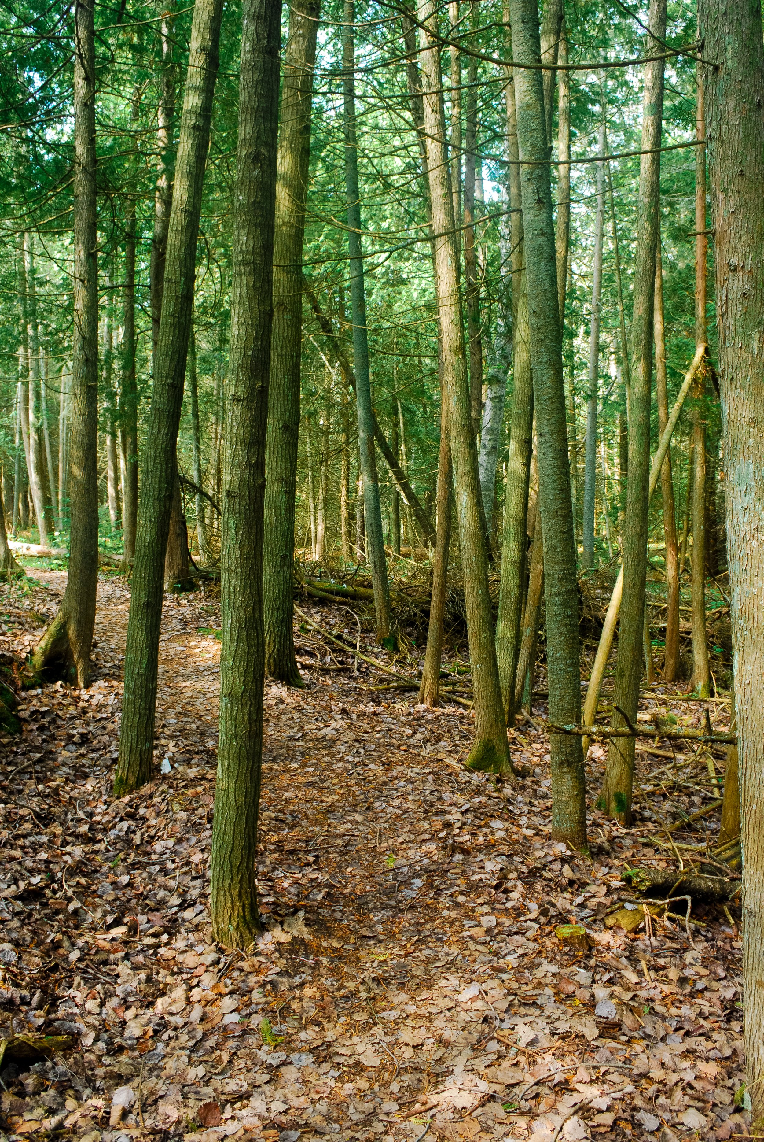
This guide organizes every designated route by region and county, highlights especially interesting drives, and includes a statewide map to help you build your own adventure.